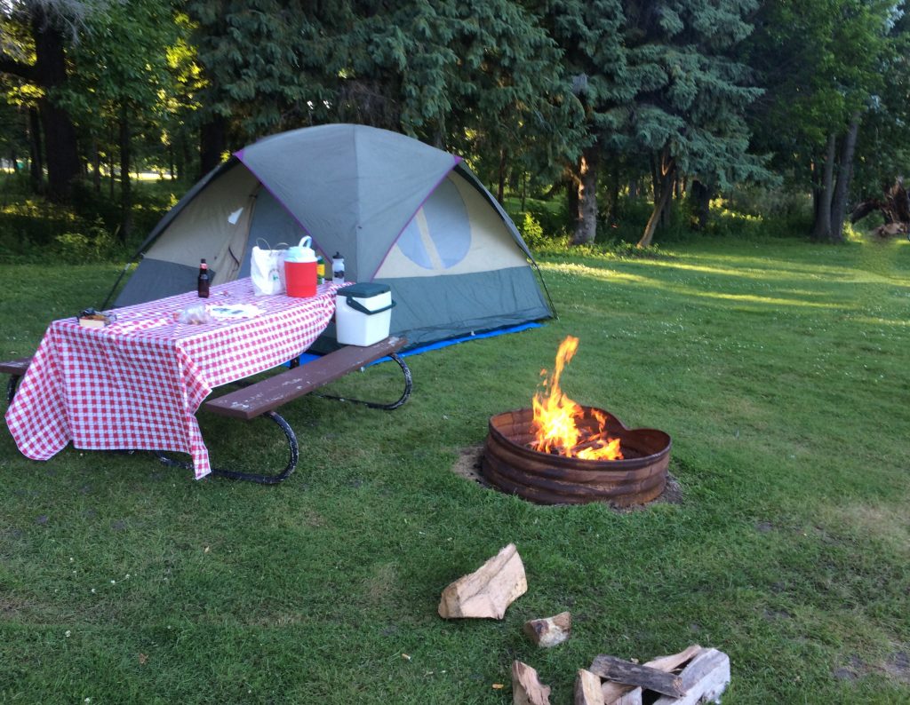
 On our recent trip to Canada we camped one night in a city park on our way home to Minnesota. We enjoyed a campfire then crawled into our sleeping bags about 10ish, but since it was the 4th of July weekend fireworks sounded late into the night and we didn’t fall asleep right away. So when we woke up in the morning we were surprised to see a tent in the site next to us. The owner must have pulled in late and set up the little tent. When I came back from the bathroom a tall, young man crawled out of the tent. We nodded at each other and I wondered if he’s traveling with anyone. As I was getting breakfast ready another young man crawled out of this tent. I thought that’s nice, he is traveling with someone but I thought the tent must have been cozy. Then to my surprise a third man crawled out of this two man tent and I started to giggle. They rolled up their sleeping bags, lifted the little tent right off the ground, took apart the two poles, folded the tent and put it all into the trunk of their car without saying a word, then drove off. It was comical to think we used our big family tent for the two of us and they had a small two person tent for three of them! What a fun way to start the day.
 Our B&B was lovely place and the location great. The proprietor was a petite woman with a wonderful accent who wore beautiful dresses. The breakfasts were European: meats and cheeses, breads & croissants, jelly, fruit, yogurt, hard-boiled eggs (with slightly soft yolks) and some cereal available for those who really wanted it. Breakfasts with our friends were leisurely, filled with lively conversation.

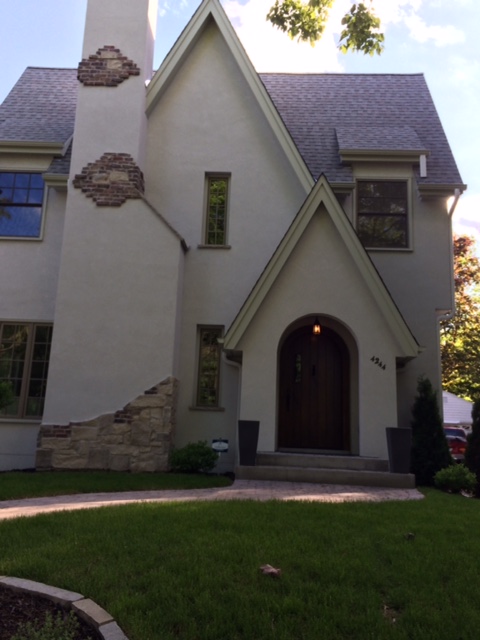 A week ago my son and his wife invited us to a picnic in a wonderful neighborhood park in the cities. They suggested we go for a walk before we eat and so we did. I mentioned to my husband on the way up that I love the charming houses in this neighborhood so it was fun to stroll along the tree shaded sidewalks to get a closer look. Right on cue (little did I know) I said, “I love these charming houses, wouldn’t it be fun tour the inside of them?” and they said, “Yes, let’s go in this one.”