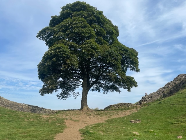
The Sycamore Gap tree along Hadrin’s Wall… September 8, 2023.
This 300-year-old majestic and gorgeous tree that I wrote about yesterday, was cut down by vandals overnight. Unbelievable. Who would do that? It is so incredibly sad.
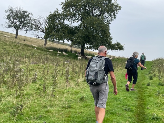
I didn’t know much about Hadrian’s Wall when we chose to hike it. I loved the idea of hiking from inn to inn, and I’ve enjoyed seeing pictures of England’s countryside, so why not there? We hiked a thirty-four mile section of the Hadrian‘s Wall Path, which is an eighty-four mile coast-to-coast trail in northern England.
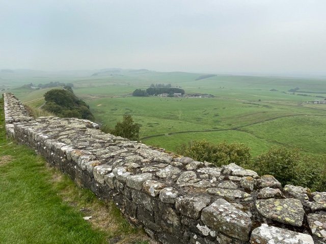
It was interesting to learn about this path that follows the course of an ancient Roman fortification wall. The construction of the Roman wall began in AD122 under the orders of Roman Emperor Hadrian. It was considered both a defensive barrier and a marker of the northern reaches of the Roman empire.
The original wall was 20 feet high and 10 feet wide. At each one-mile interval they had stone structures called milecastles which housed 32 soldiers.
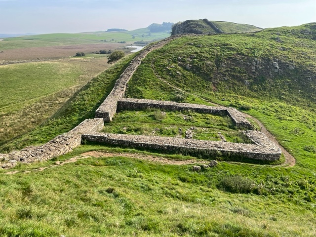
Evenly spaced between the milecastles were two stone observation posts called turrets. Additionally, the Romans had built numerous forts in proximity to the wall.
Back in its day, there was a garrison of around 20,000 soldiers from across the empire at Hadrian’s Wall. After three centuries the Romans left, and many stones were pilfered to be used to build stone fences, and stone houses, by the local people.
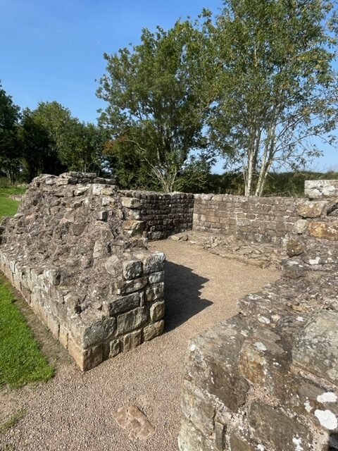
John Clayton, in the 19th century, spent 50 years excavating Chesters Roman Fort and many other Hadrian’s Wall sites and is credited for saving Hadrian’s Wall. It is now a UNESCO World Heritage Site. There is a museum along the way, next to Chesters Roman Fort, with amazing artifacts that John Clayton excavated and collected. It was fascinating.
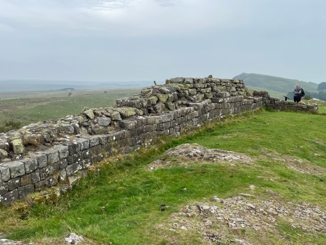
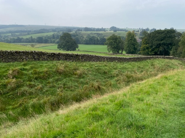
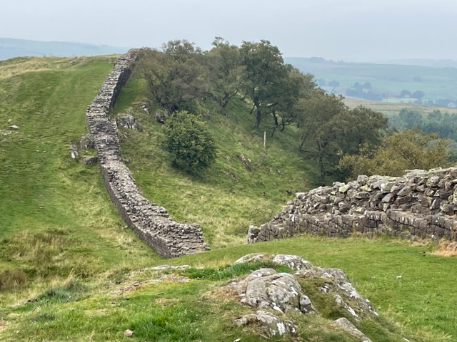
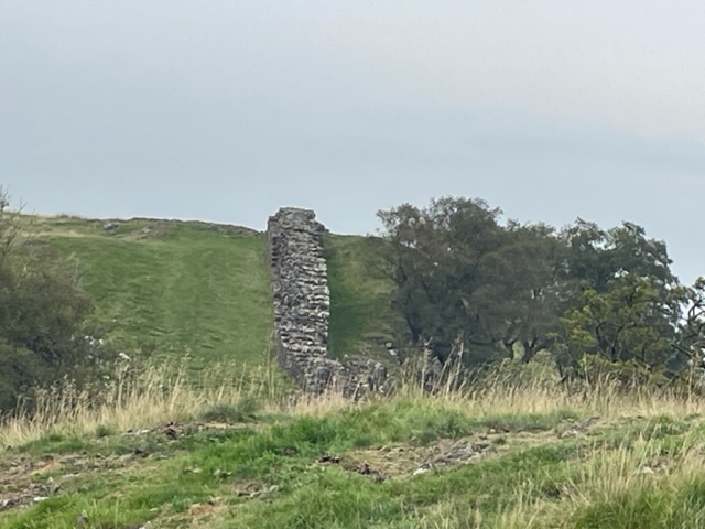
Today, the stone wall is intact in several places, up to 20 feet high, but then only a remnant stone, or nothing visible, in other places. Foundations and remnants of forts, milecastles and civil settlements were enroute with spectacular English country landscapes as the backdrop.
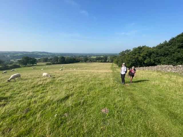
We hiked mostly in open countryside, although there were trees in the periphery… in the farm pastures and beyond.
One lone sycamore tree at the bottom of a gap along the Wall is very picturesque, and been seen in several movies apparently – one being Robin Hood. If you hike along the Wall path, it takes you down the gap to the tree, and then you walk back up the other side. The tree is stately and magnificent (and 300 years old!) The area is known as “Sycamore Gap”.
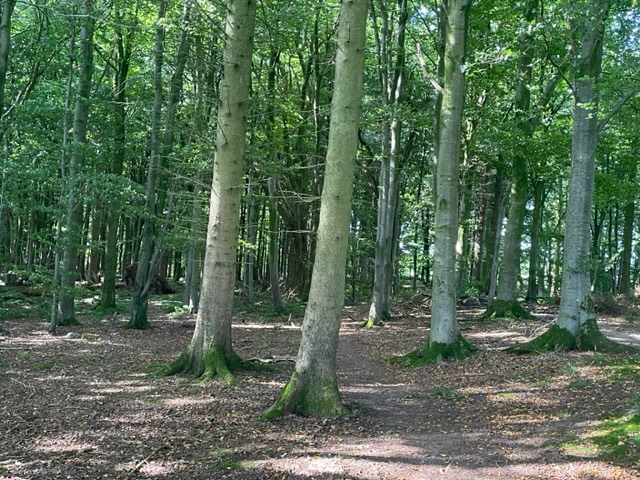
There was a small portion of the trail that goes through a wooded area…a fairy forest we called it.
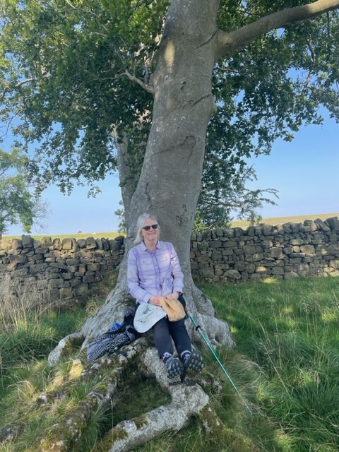
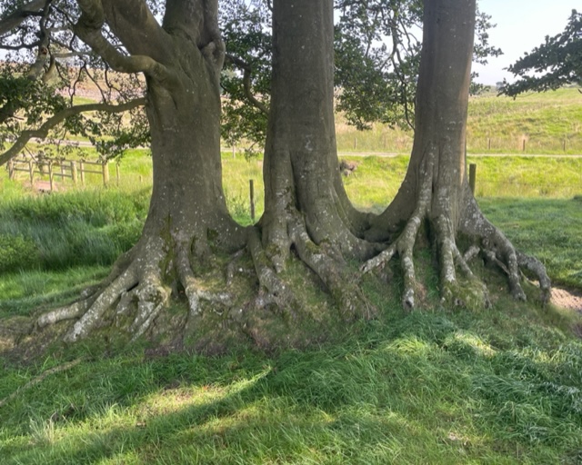
And there was a copse of trees with protruding roots that provided a perfect place for us to sit and eat lunch one day.
Beauty surrounded us on our hike, and we were grateful for the opportunity to walk this Walk through this amazing setting.
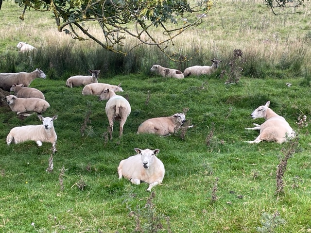
We saw thousands of sheep on our recent trip to Great Britain.
Sheep, sheep…I took lots of photos of sheep!
Thousands.
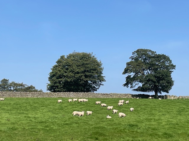
Pastoral setting…sheep, and trees, and green pasture, and blue sky, and Hadrian’s Wall…
I’m thankful they were sheep and not goats. I like sheep – goats, not so much.
Sheep are everywhere.
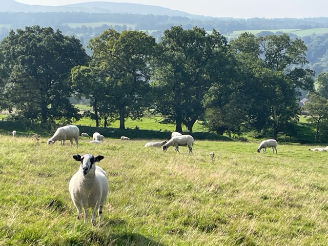
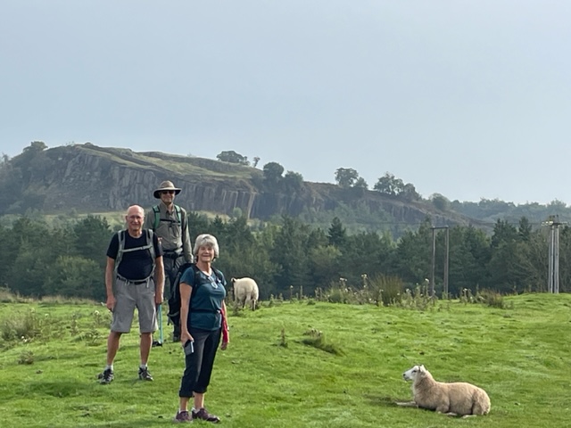
Not only were the sheep in fields along the highways and byways, but we walked right next to them in their pastures as we hiked along Hadrian’s Wall in northern England. The sheep didn’t seem to mind us hikers. They tolerated our presence and our antics towards them.
Docile sheep looking at my fellow travelers.
But the sheep also didn’t care about where they did their business as we had to carefully (and constantly) step around all the sheep droppings. They chewed their cuds as they watched us make our way through all their poo, maybe with smiles on their faces. I still think they’re cute.
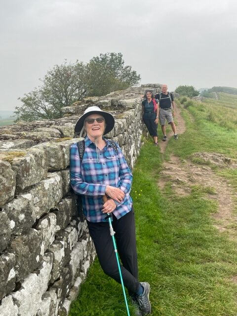
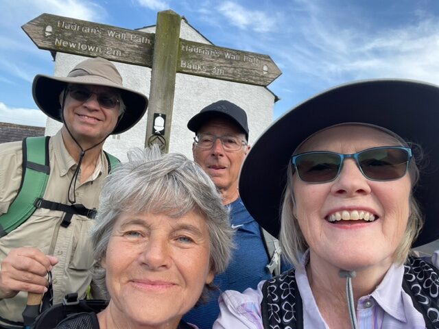
The four of us at the beginning of our hiking adventure.
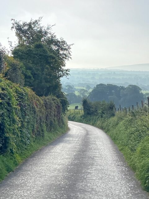
Our first steps on the first morning – walking on the road to get to the trail.
Sheep on one side, Wall on the other, expansive views of beautiful English landscapes surround us.
Only two times did we miscalculate our steps, and needed to stop and clean out poop from the cervices of our hiking boots.
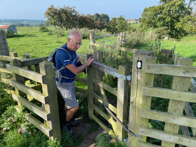
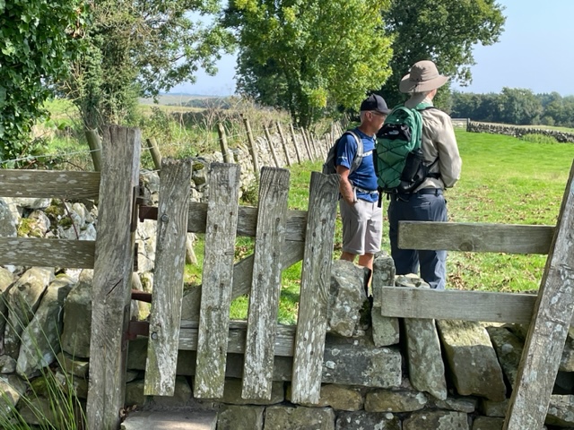
We went through many gates…
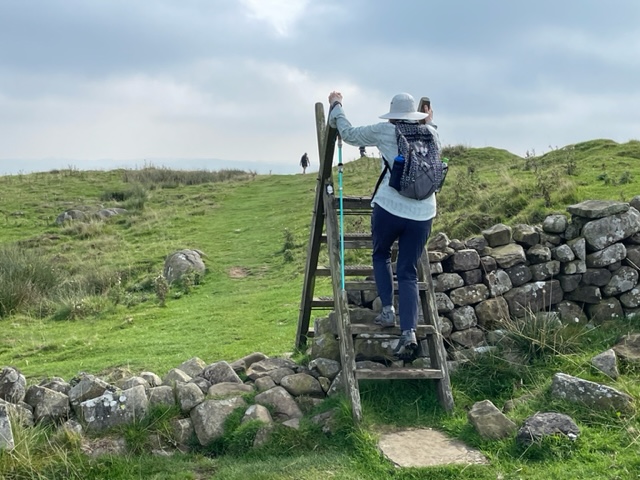
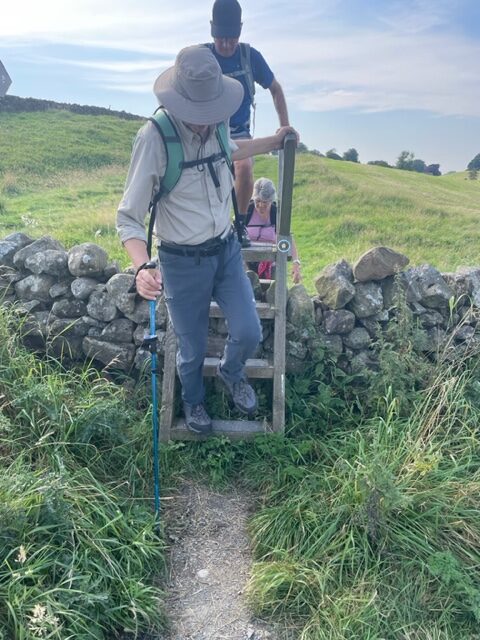
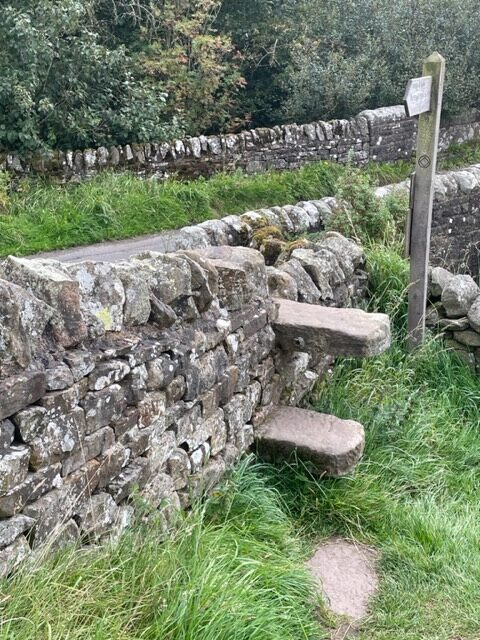
And climbed over many stiles.
Climbing over a stile.
Through the gate.
There were also stone steps in a few places.
We were prepared for what is typical Scottish weather, cool and rainy, on our four-day trek along Hadrian’s Wall. Instead, we had unusually warm, humid and sunny weather. Although we were hot and sweaty as we hiked, it was preferred to the cold and rain.
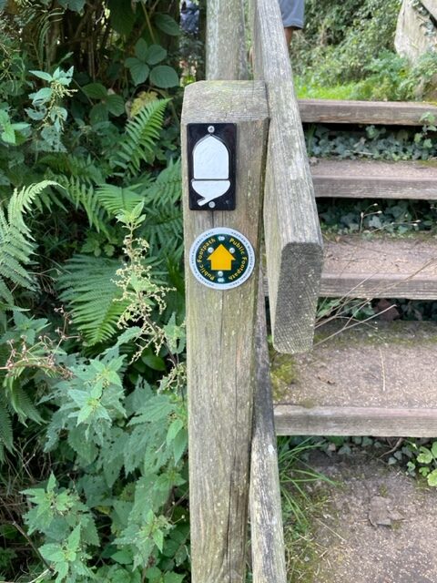
The white acorn was the trail marker for Hadrian’s Wall.
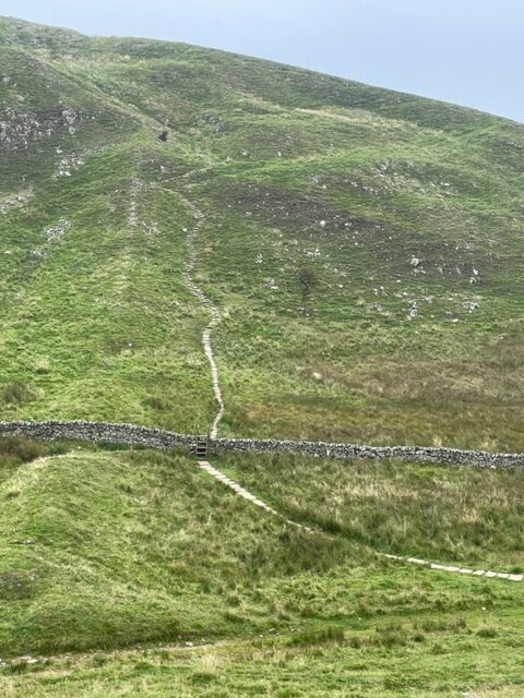
The terrain was more rugged than we anticipated, but it also made for interesting scenery and amazing vistas. We walked a total of 34 miles in four days. We were hiking from inn to inn.
Hadrian’s Wall…following it up and down…
A section of Hadrian’s Wall.
At the end of the day, we hiked off road to an inn where there were rooms reserved for us, and our luggage was waiting for us.
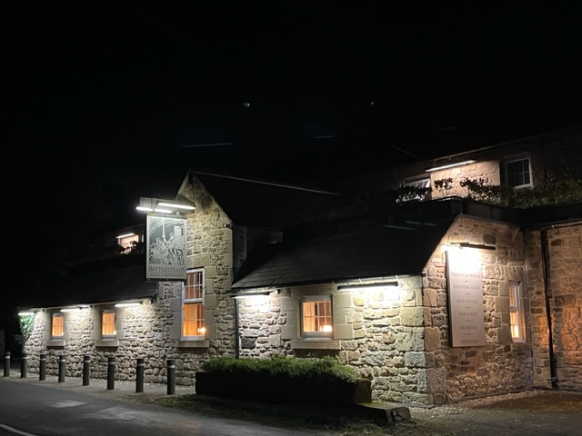
The Battlesteads B&B…located in an International DarkSky Place.
As we hiked, we only had to carry our backpacks with water, our lunch and a rain jacket (which we didn’t need).
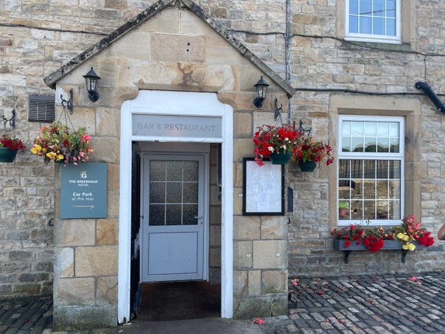
The Greenhead.
All the inns provided for our needs of a place to sleep, dinner options, breakfast the next morning, and packed lunches for the trail.
Twice Brewed Inn, in the town of Once Brewed! Love the names!
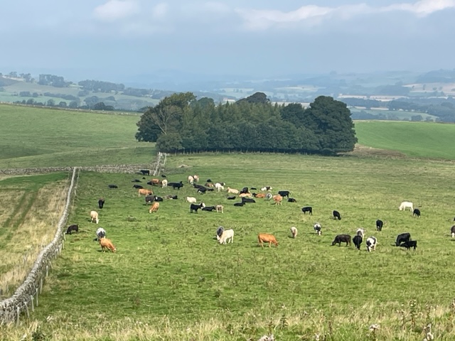
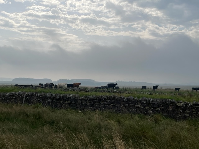
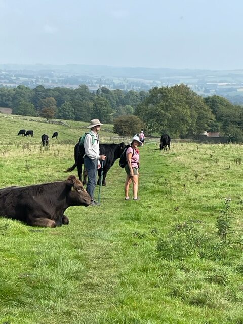
Pastoral scenes, beautiful and expansive vistas, Hadrian’s wall, sheep, various cattle, personal and lively conversations, and occasional fellow pilgrims on the trail provided our entertainment.
Walking along the trail…sometimes we could see Hadrian’s Wall, sometimes not. It’s old. It was built in 122 AD, by the Romans in Britain, as a former defensive fortification, during the reign of the Roman Emperor Hadrian.
And we had a marvelous time!
We sometimes had to watch out for cow pies too!
This cow watched as we walked off trail, by a farm, on our way to an inn for the night.
On these glorious mornings, Gary and I are walking on trails we’ve recently re-discovered.
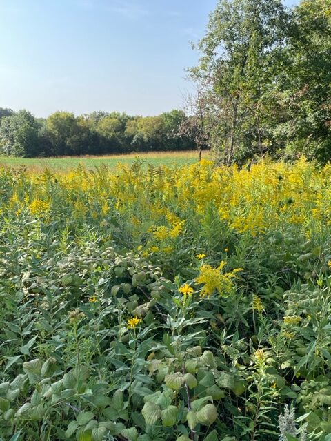
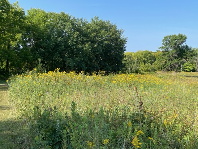
A sliver of a sea of yellow.
We park outside the Oaklawn Cemetery and pass through the gate to Carleton College’s Cowling Arboretum…the upper arb. (The lower arb has nice trails too…it goes along the Cannon River and through the woods. The entry point is at a different section of campus.)
From the entrance we use for the upper arb, you can choose to go to the right or left. The right leads down to the prairie, the left takes you through an heavily wooded area of oak trees, and all the trails connect.
The beautiful landscape with amber tips of prairie grass and golden rod…
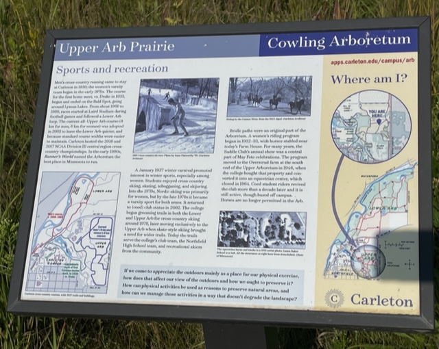
A posted sign offers information on how the different sports have worked-out on the upper arb over the years.
An interesting and informative sign about the upper arb and sports activities.
Carleton’s cross-country teams (men’s began in 1938 – women’s in 1970), practice on the trails and hold track meets. In the early 1990’s, Runner’s Magazine voted the upper arb the best place in Minnesota to run.
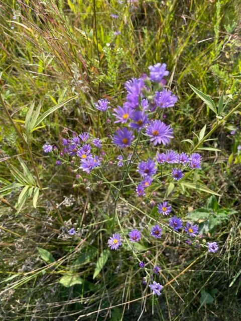
Purple prairie wildflowers…
Carleton College started grooming the trails for cross-country skiing in 1978, and continues to open the trails to all skiers. We have skied and snow-shoed in the upper-arb during winter.
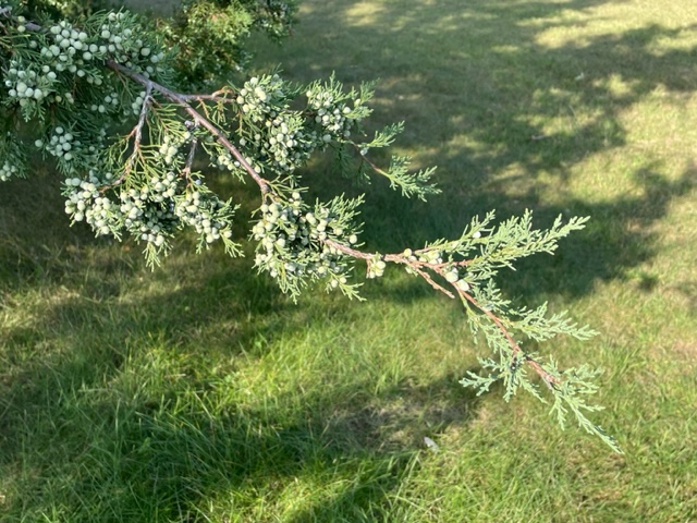
Juniper trees were abundantly full of berries.
I enjoyed learning that in the 1930’s there was a Saddle Club, and horse and riders were permitted to jaunt on the trails. An equestrian center was also built on the upper arb, but was shut down in 1964. It would be fun to ride horseback on the trails, although it is no longer permitted.
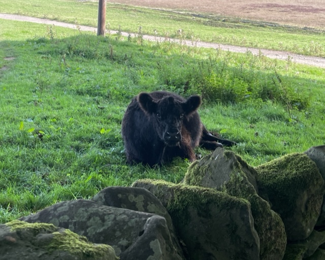
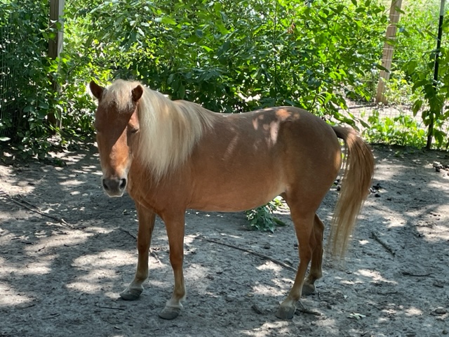
This photo added for fun…this is Abigail, one of the animals I help care for once in a while (not at the arb).
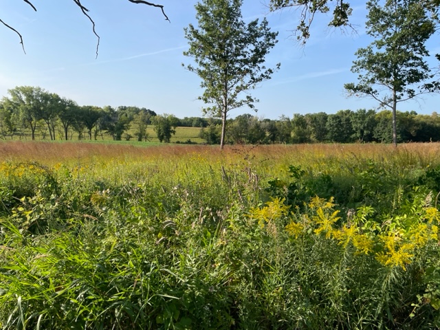
We have done a bit of walking on the trails in the upper arb in previous years, but not during this time of year when the prairie is in bloom. It is so pretty!
Intersecting trails.
It feels like we’ve discovered a whole new trail. We pass very few folks out on our morning hike. We have the trails mostly to ourselves.
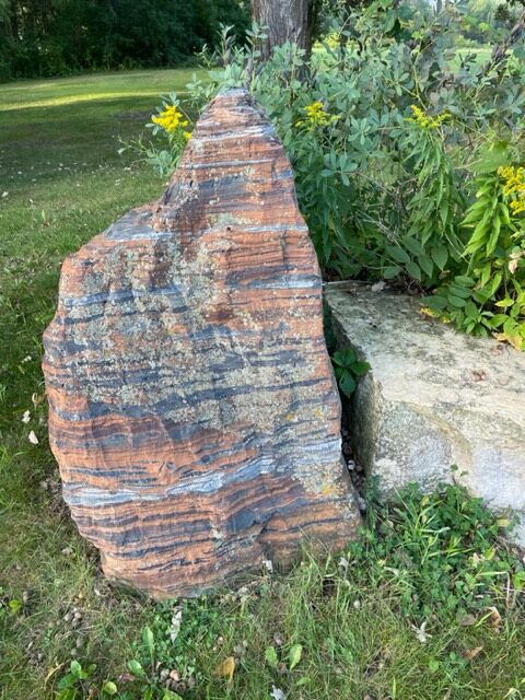
The striated lines on this boulder stood out.
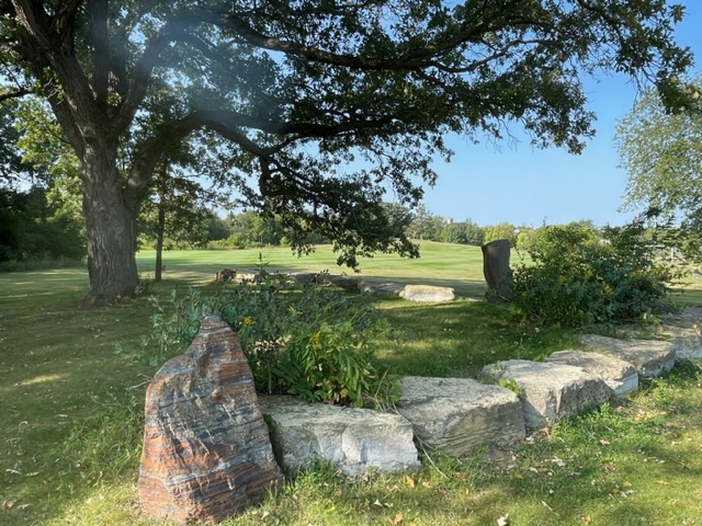
A beautifully, landscaped boulder rest area.
The sun shines on our path. The sky is blue. It is so peaceful.
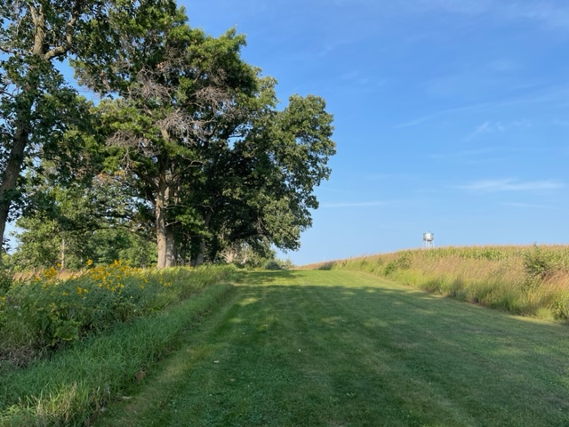
A beautifully mowed path, with Carleton College’s water tower in the background.
We’re grateful Carleton Colleges maintains the trails, and opens them up to the public.