Santorini, Greece

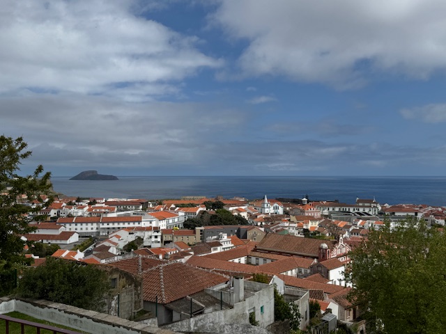
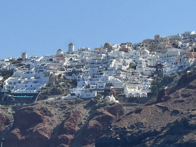
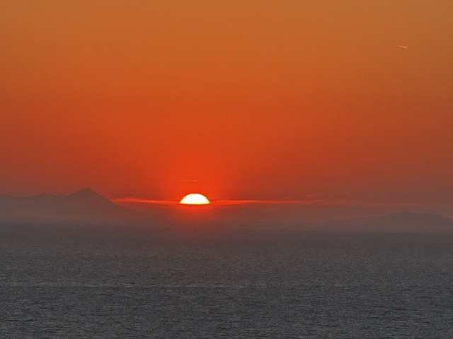
“Santorini is famous for its dramatic volcanic caldera, iconic cliffside villages of whitewashed buildings and blue-domed churches, and breathtaking Aegean sunsets.” (Google) And we got to spend four nights on this romantic island.

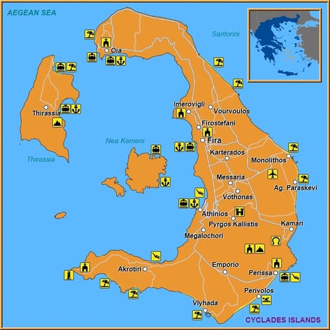
Upon arrival at the airport in Santorini, our pre-arranged driver transferred us to our resort in the city of Oia (locally pronounced Ee-ah) in the north, away from the cruise ship docks in Fira. He dropped us at the parking lot which was several hundred yards from the resort’s office, so a strong, young employee from the resort met us with a dolly.

The hotel employee pulling our luggage on a dolly.

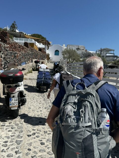
He loaded our heavy luggage (there were four of us) and pulled and pushed the dolly to the resort. It was impressive. These are narrow, uneven brick lanes, going both uphill and down…and down…and down. I’m not sure I could have carried my own luggage if I had to.

Our hotel – our room on left. photo by gb.
Our balcony.

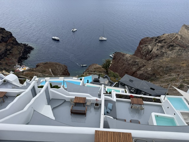
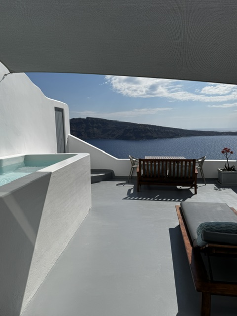
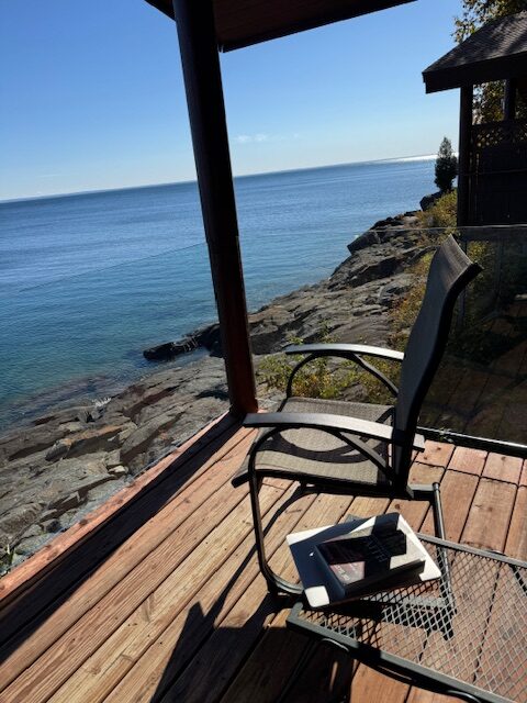
We checked in to our lovely room…with a view, and a balcony… with a hot tub. 

Look at the blue water out the window!
Very fun and interesting shapes.

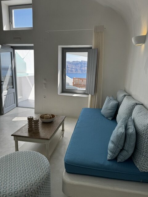
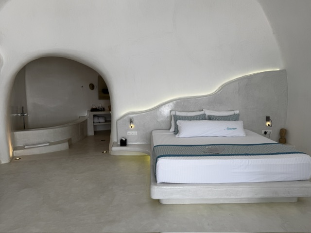
As on the other islands, the resort and hotels, houses and most buildings on the island are painted white…some with blue trim. Churches have blue domes. The buildings are cubical and some cave-like, to imitate the original cave homes on the volcanic island. We were told that in order to confuse the pirates all the homes were painted white and the small lanes created a maze.

Another view from our balcony.

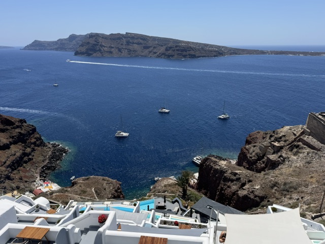
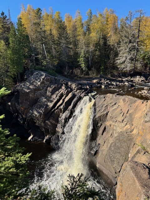
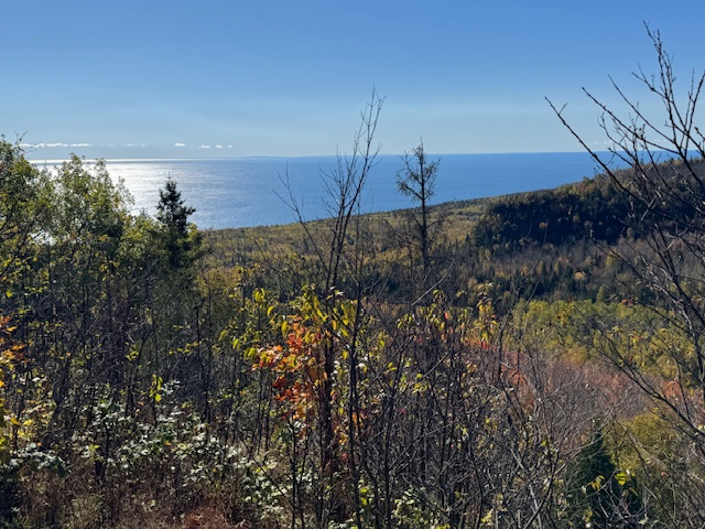
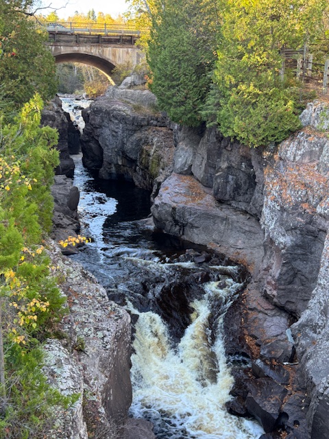
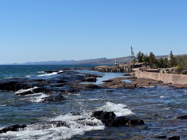
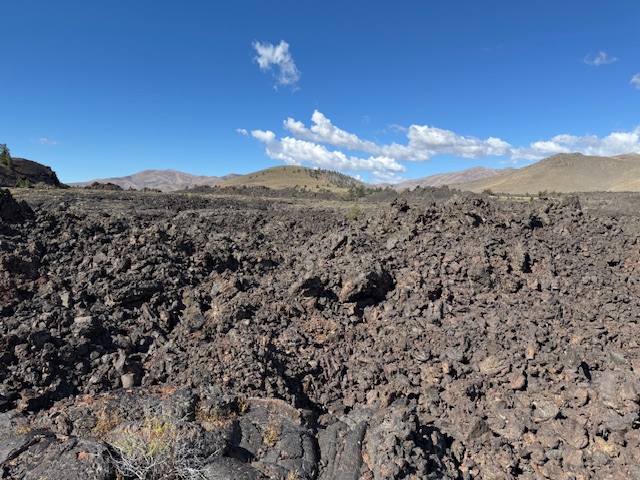
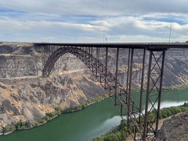
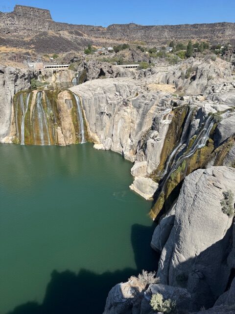
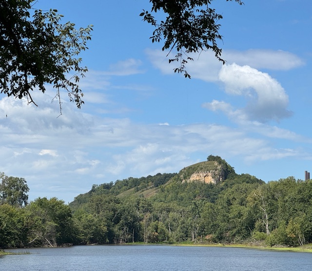
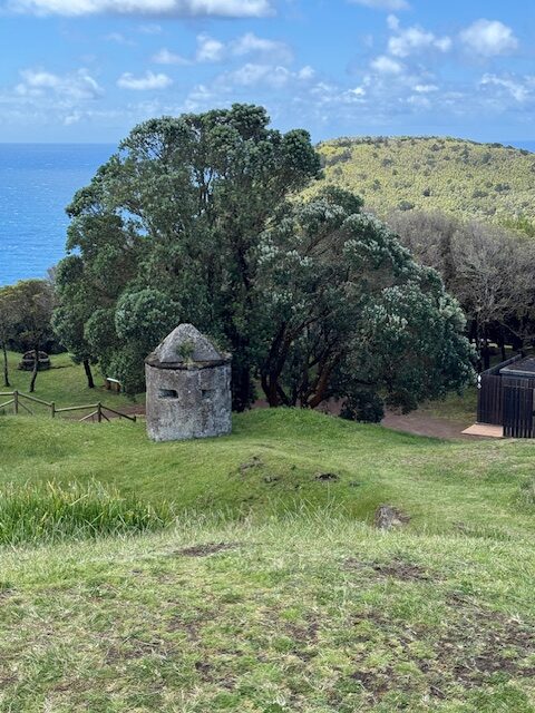
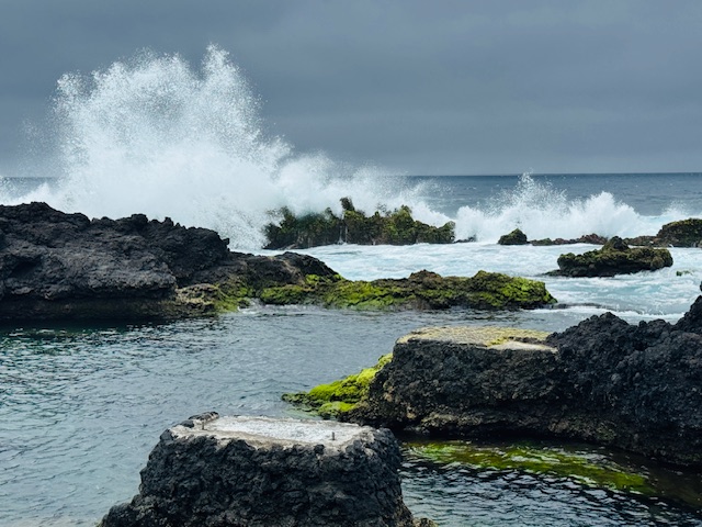
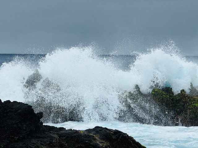
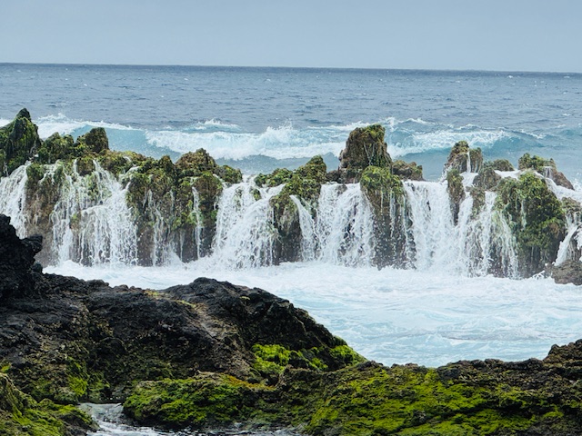
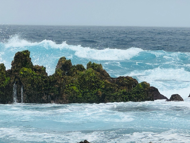
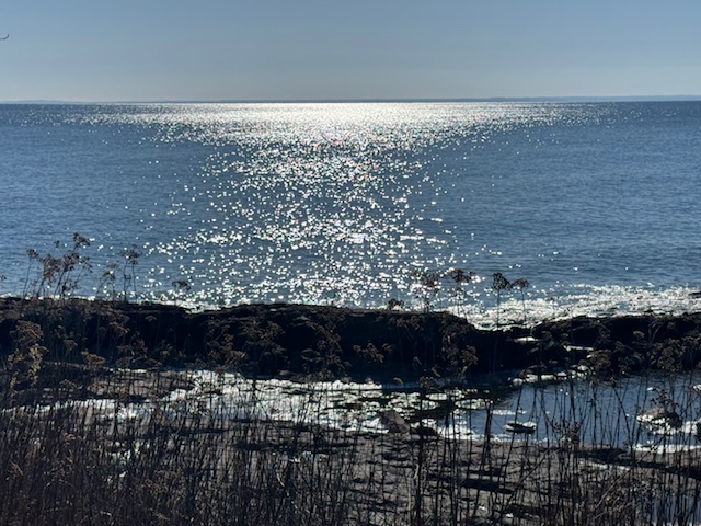
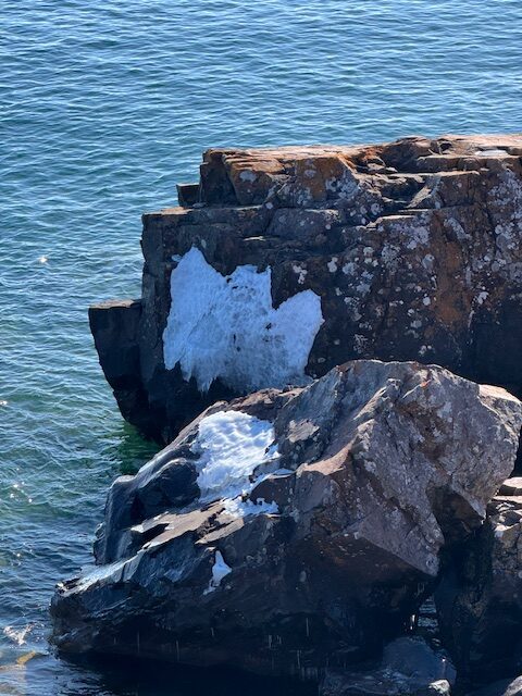
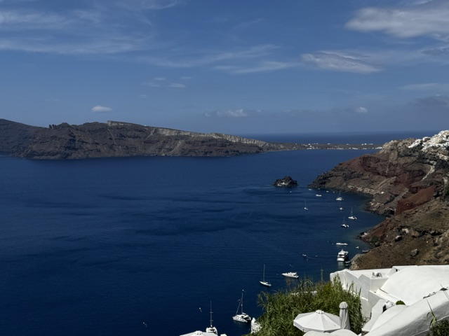
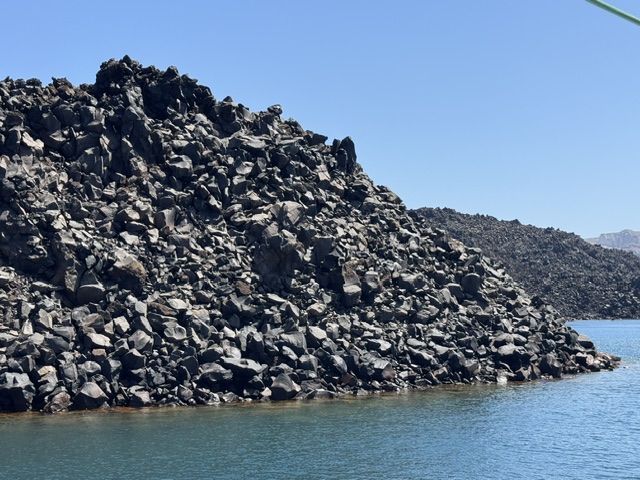
The volcano erupted about 1600 BC and created a caldera (a large, cauldron-shaped depression that forms from the explosion or collapse of the center of a volcano). The island of Santorini is one part of the edge of this caldera and therefore is a crescent shape. Thousands of years ago this caldera filled with water… the most exquisite crystal- clear blue water I’ve ever seen ~ the Aegean Sea which flows into the Mediterranean. 

The buildings built on the hillside.

The resort we stayed at was built into a hillside and, as I mentioned, has a lot of steps. This is not a place for those who cannot handle steps or have balance issues.

The narrow, inlaid, bumpy rock sidewalks.

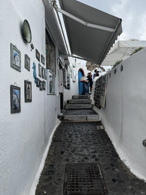
From the office of our hotel to our room there are about 75-80 steps (I lost count). We walked up them every time we left the resort. Our friend’s room was about 15 steps further down from our room. And the swimming pool and breakfast buffet and restaurant was down further still. The streets are a labyrinth… you needed to pay attention to where you were going. We used our phone’s GPS system often.

Along the sea. photo by gb.

Santorini is an amazing place. On this magnificent island we had four days to play. Besides enjoying our balconies and the pool and the restaurant, we left daily for different activities. 

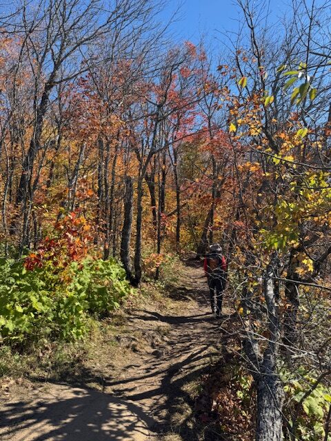
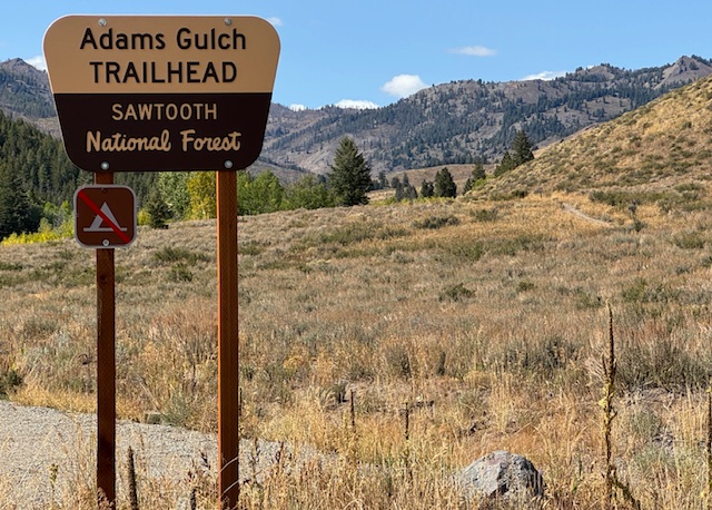
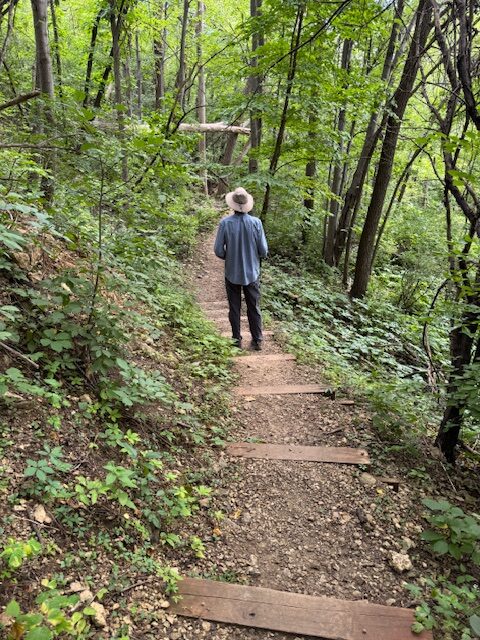
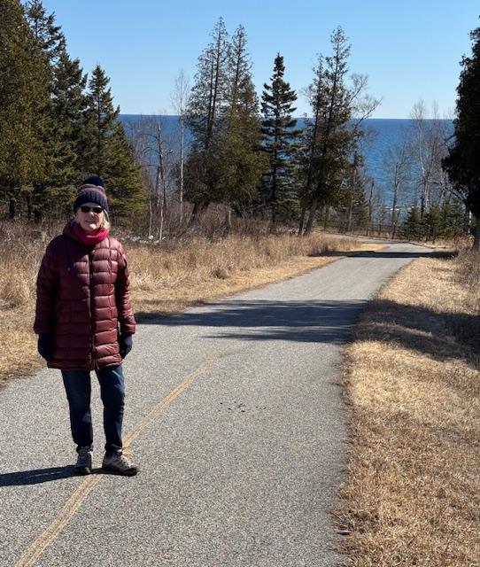
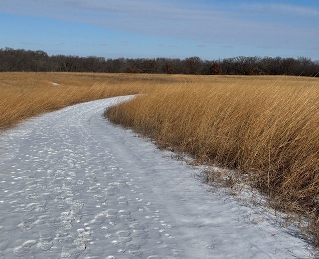
For our first day, the activity we planned was a 6 mile hike from the town of Fira to where we were staying in Oia, but it was misty (the only day it rained on our trip), so we just relaxed and delayed our hike until the next morning.

On our hike…this way to Oia. photo by dh.

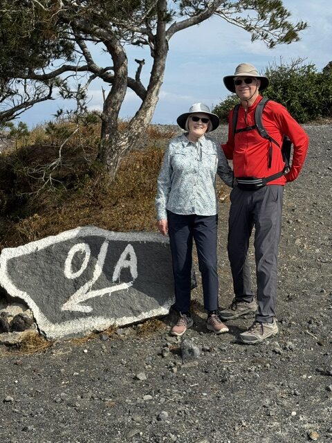
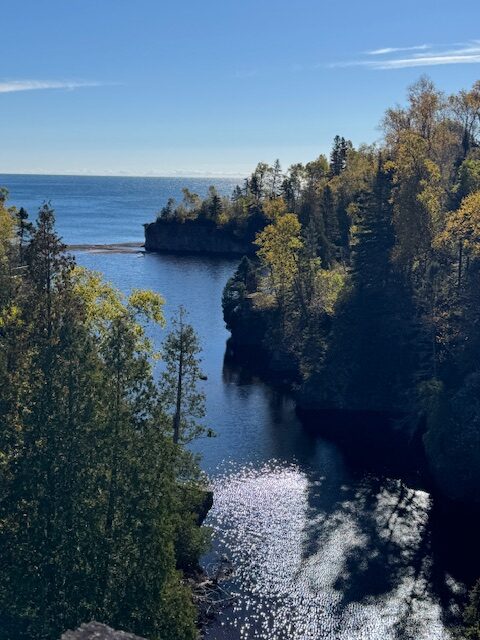
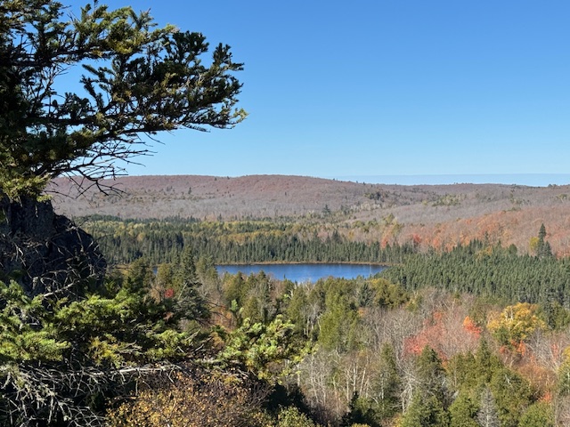
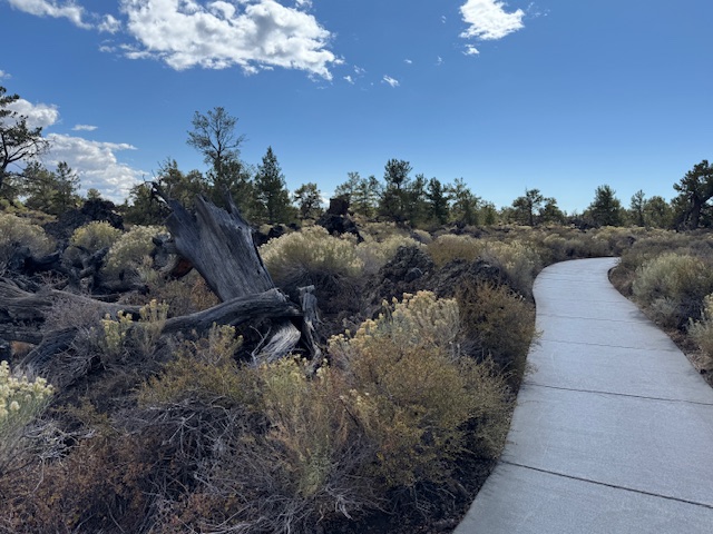
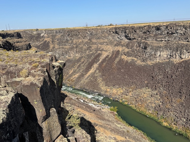
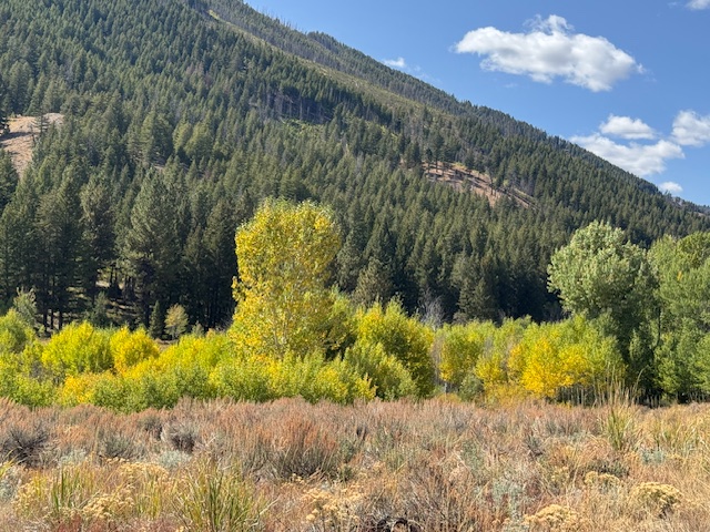
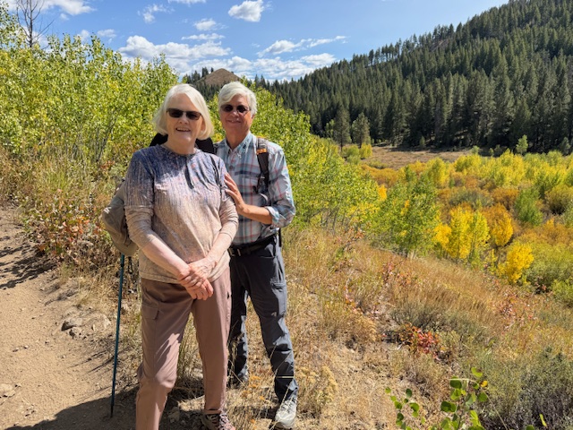
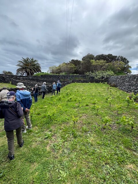
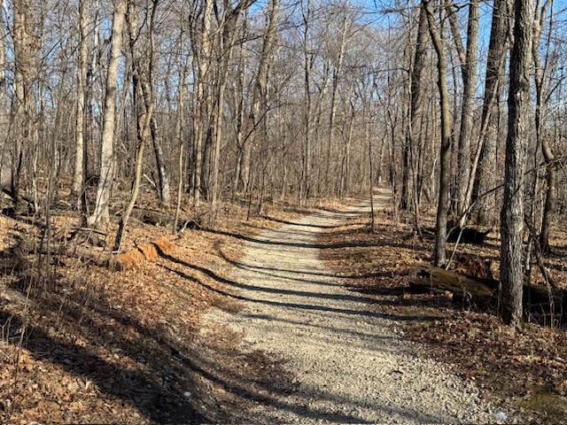
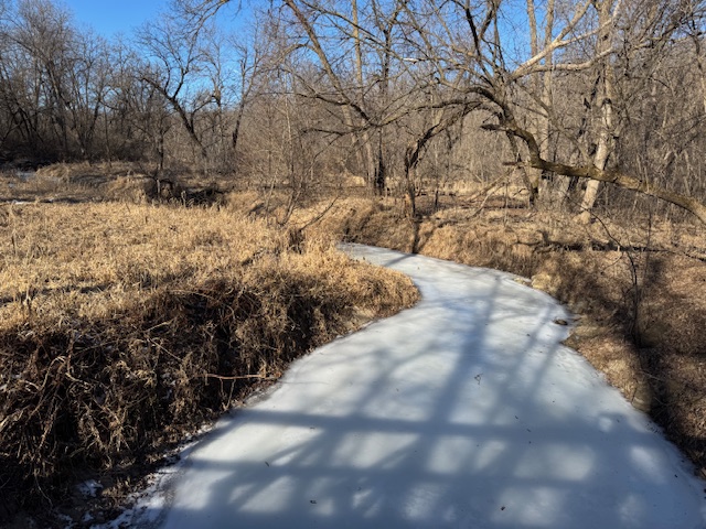
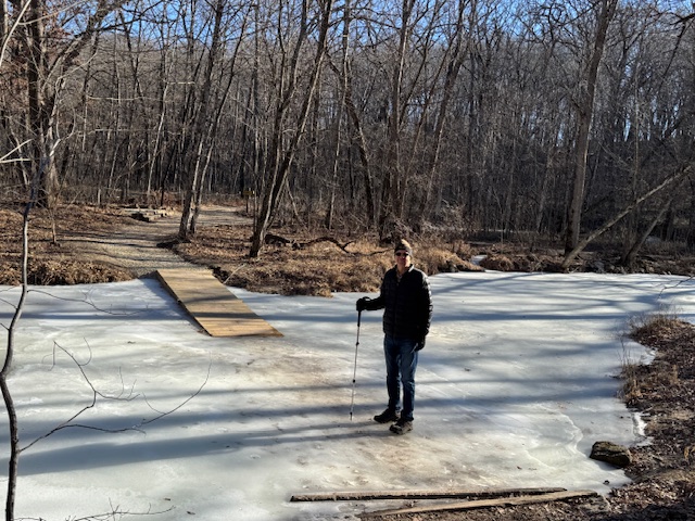
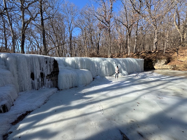
The next day we decided to shorten the hike to 4 miles or so; we hired a driver to take us to our selected hiking starting point and hiked the trail along the edge of the Caldera. It was very picturesque.

Looking back at the shape of the caldera we were waling along.
Another beautiful seascape.

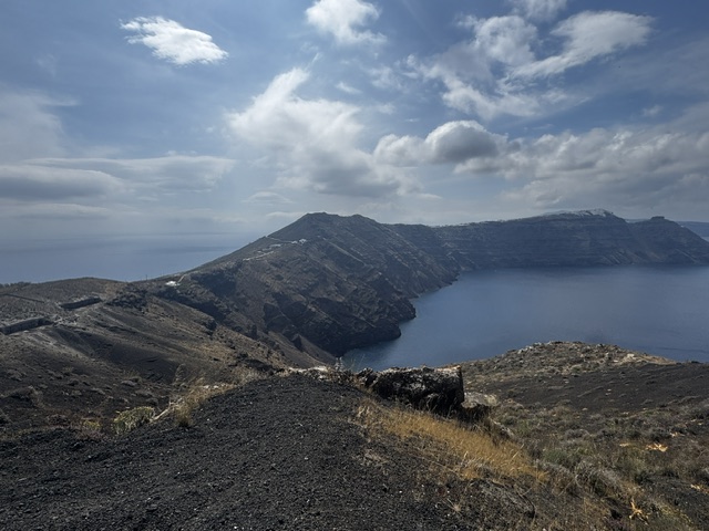
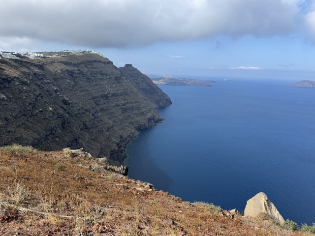
Several people were hiking this popular and spectacular trail. We learned about the hike from our son and his wife who walked the trail a few years ago.

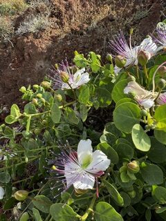
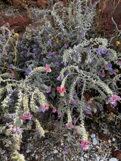
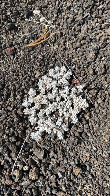
There were stunning views of the sea, and many varieties of wildflowers along the way.

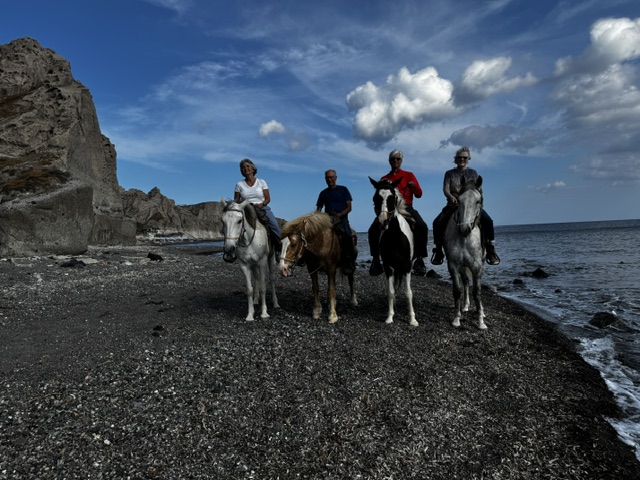
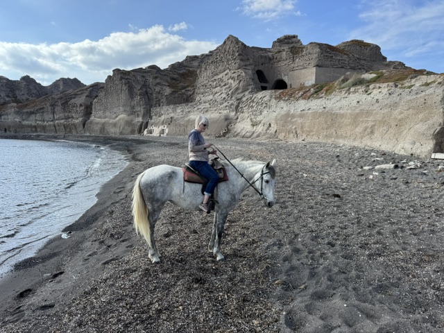
That afternoon we went horseback riding. It was a short ride down to the beach, but it was fun, and a new and different activity for us.

photo by tour guide.
My horse’s name was Georgia. photo by gb.

One day we sailed around the other islands in the caldera, on a 45’ catamaran.

The 45′ catamaran. photo by gb.

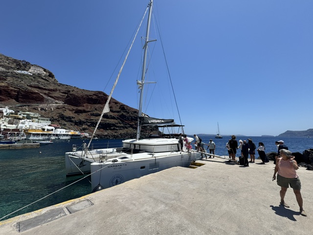
There was only one other couple for our four-hour time slot, so it felt like a personal tour. They crew served us a delicious grilled fish lunch. The boat stopped in two different areas where we were able to jump in and swim. The water was cold!!

Swimming in 64* water! Burr! photo by gb.
Island of lava chunks. Photo by gb.

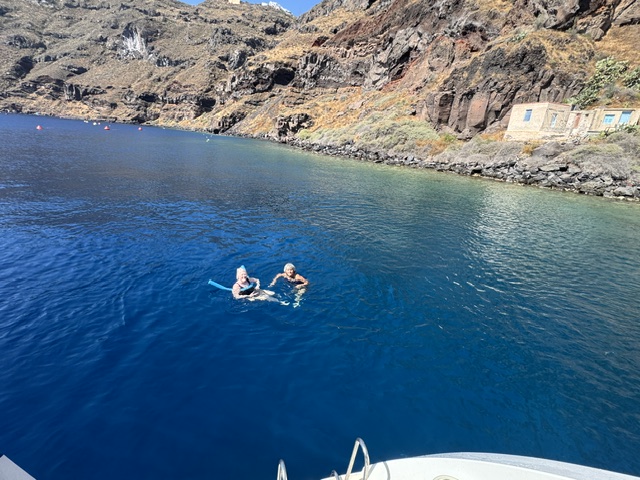
We all enjoyed sitting in front of the catamaran to watch the world go by.

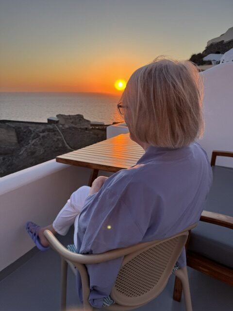
While on Santorini, we had a delicious meal at the restaurant in our hotel. It was a wonderful place, but what made it so special was first, the seating arrangement…always outside…facing west because Santorini is noted for their gorgeous sunsets.

The Aspa Restaurant, in our hotel. photo by waitress.

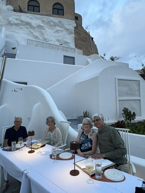
And second, we mentioned to our tour director on the cruise ship that we were staying at this resort in Santorini and he told us it is owned by one of his best friends, and he would give him a call. When we checked-in they told us we were gifted with a complimentary dinner at the restaurant. What a fun surprise. 

Amoudi Bay. A popular fishing port, nestled below our hotel. I love colors of the night on this pier.
The hotel(s) lite up at night looked lovely too.
A sunset view from our balcony. photo by gb.

It was a splurge for us to stay on this magical island for four nights, but it was memorable, and we all felt it was worth it. 

Santorini is a wonderful place to view sunsets.

We take photos as a return ticket to a moment otherwise gone.” Katie Thurmes

Lake Superior Splendor

We have hiked many trails on the north shore over the past forty years…some trails we hike every time we are up there, but we are still discovering new trails to hike and explore. 

Illgen Falls.

This year it was Illgen Falls, a part of Tettegouche State Park.

It’s a short trail to Illgen Falls, but a rugged one.

The trail to Illgen Falls is one of the shortest walks to a North Shore waterfall, and it leads to a beautiful 40’ drop of tumbling water in the Baptism River. 

The mouth of the Baptism River, where the river flows into Lake Superior.

After the delight of seeing scenic Illgen waterfall, we hiked to High Falls on the Baptism River. It’s a longer hike, with a steep set of stairs (and currently the bottom of the stairs are washed out). High Falls is a 63’ falls. It’s very majestic, yet dangerous. A man tried jumping from High Falls in August 2025 and died. 

High Falls.

We hiked up Oberg Mountain which is a trail we walk up annually.

An awesome view of Lake Superior from Oberg Mountain.

Although it was past fall-color peak (the red and orange leaves were mostly blown off the trees already), the yellows and greens were lovely.

Oberg Lake. Most of the leaves have fallen off the trees.

There are no waterfalls on this hike, but there is a beautiful view of Oberg Lake from one of numerous panoramic overlooks, and also a few of Lake Superior and  the inland forest on this loop trial.

Hiking the loop trail on top of Oberg Mountain.
The greens and yellows are pretty.

We saw waterfalls at both Temperance River and Cascade River State Parks,

Temperance River Falls.
Cascade Falls.

all intermixed with spending time sitting on shores of the Lake Superior;

Our deck off the cabin…

either reading, eating our picnic lunches,

Beachcombing.
Lovely shoreline.
Naturally tumbled rocks.

beach combing or just contemplating…it’s always refreshing, rejuvenating and relaxing. 

A stop at Grand Marais is always a treat. This year we discovered Superior Creamery. A small business that daily makes their own ice cream. It was delicious. The best vanilla I’ve tasted!

A perky sunflower outside Superior Creamery.
The harbor in Grand Marias…the water is percolating…and pretty.
The wall and rocky ledge to the Grand Marais lighthouse.
There were splashes of orange color still lingering on a few trees.

Are we in Idaho?

When I was younger, I wrote a letter to Pan Am Airlines (a viable airline at the time) asking to be put on their waitlist to go to the moon. They wrote back (I was amazed), and told me the list was full!

I guess I’ve always been fascinated by the moon. I do enjoy the moon, and especially a full moon. Seeing the moon’s reflection on the water is always spectacular. But, crescent moons are sweet too…like a wink, or smile from heaven.

Full moon over Lake Superior, Minnesota 2020.

So, when I saw on Idaho’s map, Craters of the Moon National Monument, I added it to my list of places to see in Idaho. It is a 750,000 acre park. According to the internet, the difference between national park and national monument are: 

 “...are their establishment [1] method, [2] primary purpose, and [3] scope of preservation. National parks are created by an Act of Congress to preserve a broader scope of natural and recreational values, while national monuments are designated by the President under the Antiquities Act to protect a singular, significant natural or natural object.”

It was a sunny, but chilly day when we visited the Craters of the Moon National Monument. It features vast lava fields deposited from volcanic eruption of deep fissures years ago. At the Visitor’s Center we picked up a map of a seven-mile driving loop through the park. There were designated stops along the way to get out for a scenic overlook, or take a hike. We did both. 

The short hike through Devil’s Orchard was level, and paved, and I felt like we were walking through a strange botanical garden. Although we missed the peak for wildflowers in the park, there is amazingly diverse plant life in these lava fields. Most common is the sagebrush. 

Walking through the Devil’s Orchard.

Dwarf buckwheat is an interesting plant…they look like white spots dotted almost evenly on the black lava rocks…

Dwarf Buckwheat
Dwarf Buckwheat growing like polka dots on the dark terrain.

There are numerous mini volcano formations known as spatter cones and cinder cones. We hiked up a cinder cone named Inferno Cone.

Climbing up Inferno Cone, 6181′.

A cinder cone is formed from the accumulation of gas-charged volcanic fragments (cinders) ejected from a single vent. 

On top of Inferno Cone…the top is level, but the cinder line on this photo is where the steep conical sides meet at the top.

The hike was a steep climb, but worth the view at the top.

At the top on Inferno Cone.
It’s so hard to show depth in a photo. This tree is hanging over the edge of the cinder cone.

From the Craters of the Moon brochure, “astronauts confirmed that most lunar craters resulted from meteorite impacts, not volcanism. The craters of Craters of the Moon however, are definitely of volcanic origin…. from a series of deep fissures known collectively as the Great Rift that cross the Snake River Plain.”

I may not have gone to the moon with Pan Am, but I think I am satisfied with seeing Craters of the Moon and its diverse landscape. When you enter the park and drive through this amazing area, it sure looks like you are on the moon!

It was a great adventure. 

Although not related to the moon adventure, we visited another site in the Idaho wilderness worth mentioning.

A barrack and the mess hall at Minidoka Internment camp.

The Minidoka National Historic Site is remnants of a Japanese Internment camp. We drove miles into the desert to find the visitor’s center and the remains of a few camp buildings. During World War II this camp held over 13,000 (out of 120,000) Japanese Americans who were forcibly removed from their homes and incarcerated without due process of law.

A root cellar built by those incarcerated to store crops grown at Minidoka. It is surprisingly large.

As most Visitor’s Center are, this one was full of information. And to make our visit even more interesting, the National Park ranger we talked with was a granddaughter of one of the incarcerated. Her grandfather was interned at this very Camp Minidoka. She was passionate about its history and she could answer any question we asked. The site preserves a real, but sad chapter in our history.

Idaho

When I told others we were taking a trip to Idaho most people asked why. I explained. “of the fifty states, Idaho is the only state I haven’t been in” (although my brother told me we were on a road trip with our parents and drove through Idaho to get to Washington when we were young. He is four years older so he remembers.)

Delicious potato chips, made in Idaho.

Now, if people were to ask me, “Why Idaho?” I would say because it is a beautiful state with a lot to offer…including a large portion of the Rocky Mountains and 3,500 miles of rivers. We spent a lot of time by the Snake River.

This ice cream is shaped to look like an Idaho baked potato with sour cream. It was fun to try.

Idaho is known for its potatoes. While doing some research I learned about Westside Drive-In in Boise, that offered potato-shaped ice cream. That was curious. We made the drive-in our first stop out of the airport. It was tasty treat and a great way to start our vacation. Then, we drove two hours to Twin Falls and settled into an AirBnB in southeastern Idaho.  We took day trips from there. 

The amazing Perrine Bridge.

We spent a lot of time along the Snake River viewing canyons, gorges, water falls, and watching Base jumpers jump off the Perrine Bridge…counting on their parachutes to open and land safely on the ground 486’ below. It was fascinating to watch. 

An experienced jumper attaches another person to his harness for a tandem jump. Unfortunately I couldn’t figure out how to post the video of this endeavor.
This screen shot is of the BASE jumper from one of the videos.

The Perrine Bridge is a stunning arch bridge and stands 486 feet above the Snake River, and has the distinction of being the eighth highest bridge in the United States. The Perrine Bridge attracts BASE jumpers from all over the world because it is one of the few structures they [jumpers] can use without getting special permits.

Trying to capture how deep this gorge is…this is looking down at the river…ripples from a motor boat and a kayak in the picture too.

(BASE jumping is an extreme sport where an individual leaps from a fixed object and uses a single parachute to land. The term “BASE” is an acronym for the four types of locations: Buildings, Antennas, Spans (bridges), and the Earth (cliffs).) We were fortunate to witness four jumpers, (one tandem) while walking next to the bridge.

At the visitor’s center, on the other side of the bridge, was a temporary 911 memorial display (we were visiting close to that date). The group hung a gigantic American flag on a cable over the gorge. It was impressive.

Shoshone Falls…there is not much water flowing over the falls this time of year. (Twin Falls is considered high dessert.) However, in the spring Shoshone Falls is called the Niagara of the west and the falls are gushing and look very full (in photos).

We picnicked at Shoshone Falls, and saw Perrine Coulee Falls and many other miscellaneous waterfalls.

Perrine Coulee Falls.

We also walked to the Devil’s Washbowl, a waterfall within the Malad Gorge in Thousand Springs State Park. 

The waterfalls in Malad Gorge.
Looking down on Malad Gorge, formed by the Malad River that flows into the Snake River.

We hiked in Adams Gulch and caught the beautiful sight of quaking aspen trees, their leaves turning from green…to lime green… to a brilliant yellow, that contrast beautifully with the green evergreen trees.

The striking contrast of the yellow aspens and evergreen trees.
We hiked on a well-defined hiking, and mountain biking, trail.

We drove to Ketchum, the ski village near Sun Valley Resort, nestled within the Rocky Mountains, specifically in the Wood River Valley at the base of Bald Mountain.

Beautiful Bald Mountain and the Sun Valley Ski Resort.

Sun Valley was America’s first destination ski resort.

One big bicycle near Ketchum.

The mountains are inviting so we continued to drive north of Ketchum for several miles to see their majesty.

On our way up a mountain…and then down into a valley.
Looking at a valley from Smiley Lodge. We turned around here and drove back up the mountain pass.

We also spent time in Craters of the Moon National Monument. I will write about that another time. 

Our final evening, a farewell dinner on the deck at Redhawk Gastropub, overlooking the Snake River.

Our time went fast, as it usually does while on vacation, but I’m glad we were able to see a few of the wonderful sights in beautiful Idaho, and to make some fun memories there. 

And I did it! I can say I’ve been in all 50 states. 

Barn Bluff

The new entrance sign for Barn Bluff, also stating the Native American name.

We have hiked Barn Bluff before in Red Wing, Minnesota, but I had not known the Native American He Mai Can name meaning Hill, Water, Wood. And I had not heard the Native American legend before.

An informative sign on the trail.

A sign at the beginning of the Barn Bluff trail tells of this legend, and it also lists names of a few famous people who have hiked the trail, including Henry David Thoreau.

A view of Barn Bluff from Colvill Park.

The legend is told by Henry Lewis (1819-1904), an artist famous for his paintings of the American West. It reads:

Many hundreds of years ago a mountain twice as big stood in this place. The inhabitants of two Dakota Villages quarreled over possession of the mountain, and to settle the dispute without bloodshed, the Great Spirit divided it into two parts. He left one part here and moved the other half downstream to a second village. The portion that was moved, according to Lewis's interpretation, rises above today's city of Winona and is called Sugar Loaf.

I have not climbed Sugar Loaf Bluff, but I have seen it while visiting Winona.

One of the Barn Bluff trails.

We had a perfect weather day as we hiked up Barn Bluff: sunny skies with puffy white clouds, low humidity with temperatures in the 70’s.

Overlooking Red Wing, MN.

We enjoyed our hike to the West Overlook, which offers great views of the Mississippi River, Red Wing and Wisconsin.

A barge on the Mississippi River.

Henry David Thoreau’s quote on the sign described the view as, “Verdant plains, fruitful meadows, and numerous islands abound with the most varied trees,…But above all, reaching as far as the eye can extend is the majestic, softly flowing river.” I imagine the river is much the same, although the landscape is very different since Henry spoke those words. I like his description of the mighty Mississippi River, as softly flowing.

“…the majestic, softly flowing river.” Henry David Thoreau

After our hike we drove through Colvill Park along the river in Red Wing. This is a great eagle viewing area in the wintertime. We thought we’d check for eagles on this summer day, and we did see two eagles perched high in a tree. 

Two eagles in the tree tops in Colvill Park.

We ate lunch in Lake City, at a restaurant that has an outdoor patio on the shores of Lake Pepin. There we saw another eagle. This one sat in a barren tree, keeping an eye over the patrons the whole time we were at the restaurant. 

Sailboat on Lake Pepin.

On our hike we encountered a woman with four young children. She may have been a grandmother (but seemed more like a daycare worker). I thought to myself, “good for you to bring these kids out for a hike in the woods”. It was encouraging to see children enjoying nature.

Butterfly on liatris.

Later, while in driving through Colvill Park, we saw this same woman with the four children having a picnic lunch. Colvill Park is a large park, with a massive playground, and it struck me that they were the only ones in the park. These four children are very fortunate to have a caretaker who values the out-of-doors.

The flag flies on the top of Barn Bluff.
The sumac was already turning color…oh my!

Terceira

We arrived on the island of Terceira a day before our official tour with OAT began.

Overlooking the city of Angra do Heroismo on Terceira.
A lilac-color hydrangea in bloom.

We wanted to acclimate our body clocks, plus we wanted to get a hike in with our friends we travel with.

A stop along our hike up Mount Brasil.

We had a good weather, a sunny day and an interesting hike up Mount Brasil. 

An inviting trail on Mount Brasil.
Looking over a caldera, to the Atlantic Ocean.
Looking to the ocean from Mount Brasil.

The next day we met our OAT tour group. OAT promotes discoveries and experiences, so they bring the groups to small, local businesses and out of the way places, and even make unscheduled stops. One day we stopped at a farmer’s market and a fishing dock to talk with a local fisherman, neither one on the schedule for that day.

At the fishing dock, a local fisherman shows us the bait that has been assembled for the next round of fishing. These are fish heads/parts secured on a hook for a fishing line.

A few of the many experiences on the island of Terceira was a small winery tour, an organic coffee/banana plantation tour, seeing the dramatic tide pools, and having dinner with a local family. All were remarkable in their own way.

Buildings for the winery built from lava rock.
Several volcanic rock walls create an amazing vineyard.

The Materramenta Winery was interesting. The vineyards were enclosed, and divided, by volcanic rock walls making it picturesque,

Some grapevines were planted in rows in a small area.
Other vines were planted in deep volcanic rock holes – a special planting method. photo gb
An interesting vineyard.

plus adding a unique and great flavor to the wines apparently.

The olive tree in the corner is to detract birds from eating the grapes. photo gb
The lava rock walls were strategically put together to allow air flow.

After a tour of the vineyard, we were invited into a tasting room with a long, welcoming table.

Setting for our wine tasting at this small winery.

The coffee/banana plantation was so different from the winery, yet beautiful in a different way. It was very lush.

José, the owner of an organic coffee and banana plantation gives us a tour.
A bucket full of organic coffee beans.

José, has expanded his small business into eco lodging and built a few small camping cabins in the midst of the plantation.

A nice camping cabin on the coffee plantation, complete with indoor plumbing!

The a-line cabins were inviting, and are creating more income for this family.

One of my favorite pictures at one of my favorite spots on our trip.

One of my two favorite activities on Terceira was going to the Biscoitos tide pools to watch the waves crash over the volcanic boulders along the shore.

Making a big splash!
Mini waterfalls created by waves crashing in.

It was mesmerizing. A fellow traveler commented with waterfalls the water flows down, but along the shore when the waves hit the rocks the water bursts up into the air.

Beautiful colorful water.
Aqua colored water coming in.
Biscoitos tide pools.

Another favorite activity was a local home visit. One evening our big group was divided into three small groups and folks on the island invited us into their houses for a home-cooked dinner, and for a peek at how the islanders live. It was wonderful.

We were invited into this beautiful home for dinner. photo gb

Due to different circumstances, our host was on his own with all six of us, but his wife had the meal mostly prepared and he pulled it off flawlessly. He was a great host and his 17-year-old and 6-year-old joined us near the end of dinner. We had a delightful evening.

Roger, our home host, adding the final touches to dessert.

And that was not all (that we did on Terceira)…But it is enough…(for now).

The North Shore

We went up to the north shore to celebrate my birthday last week.

3/20/25, 7:17 am

There was a beautiful sunrise the morning of my birthday, and the sun continued to shine all day long.

We wanted to do a little hiking. We had tried hiking at Gooseberry Falls the day before, but we had to turn back due to a very icy trail. Although there was no snow on the ground anywhere, the shaded trails in the woods still had ice cover making it difficult to hike on them.

When we stopped for a specialty coffee at Vanilla Bean in Two Harbors, another customer joined our conversation with the waitress about places to hike in the area that might not be icy. The stranger asked us about the Gitchi-Gami bike trail. And it was one of those ah-ha moments; “I can’t believe we didn’t think about the wonderful paved bike trail with sections all along the north shore.”

An portion of the Gitchi-Gami Bike trail along Lake Superior.

So we found our safe place to hike along Lake Superior, and it was lovely.

Glistening waters.

Besides the sparkling lake, we saw different images on two different hikes. Do you see what I see?

A bat…a sheet of ice still clinging to a large rock in Lake Superior, facing south (no sun to melt it).

The head of a wolf (right), and a deer lying down looking out (left) in the hollow of a tree.

Several little bear cubs climbing up the tree.

It was a fun birthday; with hiking, cabin time, and watching the waves roll in. A great beginning to another trip around the sun.

A Week Later…

Last week we had below zero temperatures.

This week…balmy temperatures…comparatively. 

The Faribo Flyers Bike & Ski club have an annual winter picnic. This past Sunday was the day for this winter, and it was 50* outside. Instead of being bundled in all our winter gear and eating with our mittens on as per usual, we were wearing our spring jackets enjoying the unusually warm weather. What a difference a day makes.

This photo was taken in 2021. There was not that much snow on the ground at River Bend Nature Center this year.

After hiking almost 4 miles, we came back to a large bonfire in the oval fire ring…all ready for us to roast hot dogs and enjoy all the goodies everyone brought for the potluck portion. It was tasty – we think food always tastes better in the outdoors. Nobody was standing around the fire to keep warm. We were engaged in conversations and relaxing in the Sunday afternoon sunshine. 

It’s easy to play outside in this kind of weather…

The goats were fun to watch at River Bend. 2/2/25

On another note…we have hiked at River Bend a few times this winter. Before the cold snap, there were goats penned in a large area to eat the invasive Buckthorn. They were fun to watch. Apparently there were 120 of them! They removed the goats due to the extreme cold temperatures last week, but plan to bring them back again this spring to let them munch in another location.

February 2, 2025

Frozen Falls

We went for a hike the other day, in 40* weather. We’ve had a few below zero days this winter, but last week we had a stretch of unusually warm weather for a typical January in Minnesota.

We have had only one measureable snowfall, and that was in December, so there is not much snow lying on the ground. As we hiked the trails through the bare trees in Nerstrand Big Woods State Park, we were walking on dirt. The sun was shining bright, with no clouds in the sky. The temperature climbed into the 50’s by afternoon. 

No snow in the state park on this day.

When we arrived at the park, we noticed a group of hikers were just starting their journey on the trail we usually hike. So we decided to reverse directions and “start at the end of the trail.”

The frozen Prairie Creek.

After a while we came to the creek, frozen over. As we crossed the bridge we took in the pretty sight of a smooth, sparkling white curve cutting through the brown landscape, with a blue sky overhead. It looked like an inviting trail, not a creek.

Gary walking on iced-over concrete blocks.

We continued on, crossing a frozen patch in the creek, covering the concrete block path that serves as a way across Prairie Creek normally.

We arrived at Hidden Falls. We wondered if there would be any water flowing and found it completely frozen over. It was like the White Witch of Narnia had cast her spell on these falls and the water froze instantly, in place.

Hidden Falls in Nerstrand Big Woods State Park.

It was beautiful…this blanket of white ice on this unusually warm day. Such a contrast between no snow on the ground, brown soil and trees, blue sky and lots of frozen water. It was such a great winter scene.

You can picture the water falling and splashing over the falls, now frozen in place.

We managed to sneak in a couple of photos before the other hikers descended upon us. They asked us to take their photo, and reciprocated and took ours. We found out they were a hiking club from the cities and they were identifying trees in winter. I think that would be difficult.

January 2025.

We continued on our fun hike…glad to be out of doors on such a winter’s day.

“Frosty outside, toasty inside.”

Those were the words I wrote in a cabin journal, inviting guests to leave comments about their experience at a camping cabin where we recently stayed for a couple of nights. These camping cabins have heat and electricity. They have large bunkbeds, built-in shelves, table with benches, but no indoor plumbing. There was water available close to the cabin.

The newly built cabins were well-made with pine siding, and the wonderful smell of pine permeated them. They have a screen porch (not useful in winter) and great views. It wasn’t really “glamping”, but coming in from the freezing temperatures outside, into the warm, cozy temperatures inside the cabin felt luxurious.

Cooking outdoors, eating indoors.

We scheduled a few days away at the cabin long before we knew there would be below zero temperatures. We brought along hand warmers and toe warmers and all our outdoor, winter gear we needed to be comfortable outside.

Bundled up, by the campfire.

We were hoping to cross-country ski and snowshoe, but there was little snow on the ground so that didn’t happen. We managed to get in a couple hikes and have a camp fire to grill hotdogs. 

A hike through beautiful prairie grass.

The sun glistening on the snow-covered lake and the golden prairie grass along the trails showed off the beauty of a Minnesota winter. 

The full moon in January is called the wolf moon.

There was an added bonus of the full January wolf moon. Getting up in the middle of the night to walk outside to the restroom was made tolerable because of the moon shining down, casting a charming spell on the landscape. We didn’t even need a flashlight to light our way to the heated, shower house. It made walking in the below zero temperatures a little less painful. 😉

It was a fun get away, and most definitely…frosty outside and toasty inside.