This is the day the Lord has made, let us rejoice and be glad in it.
                                                                                                Psalm 118:24
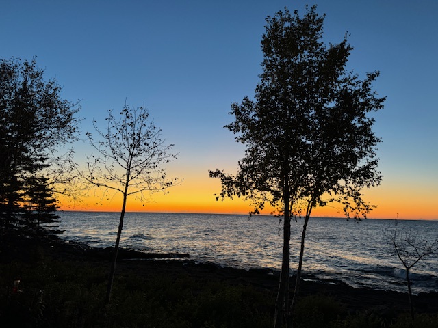
First morning light…6:35 am 10/1/24
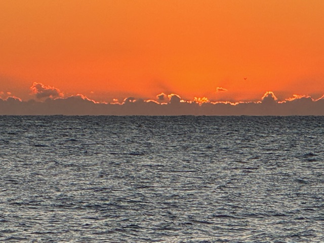
7:03 am on 10/1/24… the moment of sunrise.
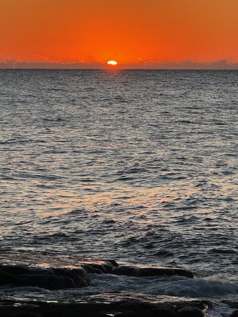
7:04 am on 10/1/24…here comes the sun.
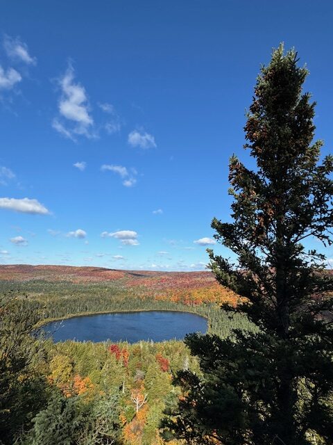
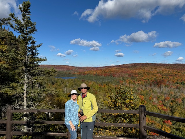
A couple hours later we trekked up Oberg Mountain and saw more beautiful colors of a different kind. Once again, I was grateful to be able to hike this trail, and was thankful to have the opportunity to do so.
10:00 am on 10/1/24…Oberg Lake
10:00 am on 10/1/24
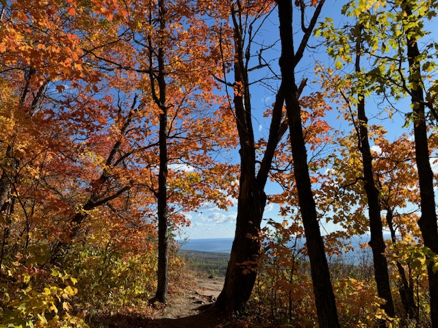
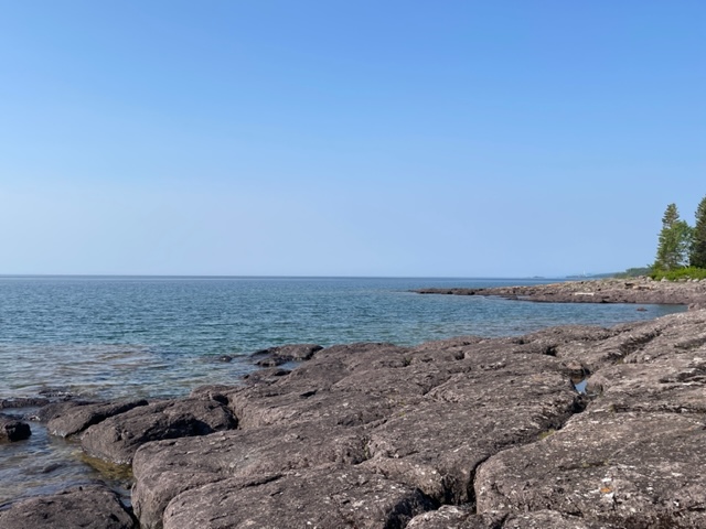
10:15 am on 10/1/24…a view out to Lake Superior on the Oberg Trail.
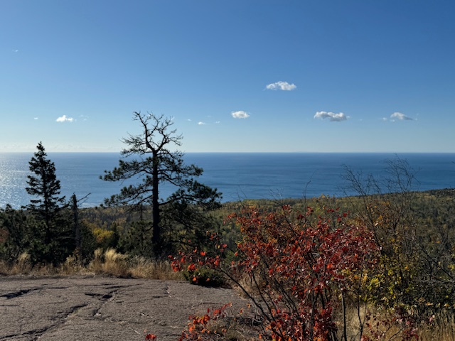
10:30 am on 10/1/24… one of seven outlooks on the Oberg Trail.
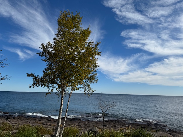
And back at the cabin…the lovely, wispy clouds.
2:30 pm on 10/1/24
The sky was constantly changing, but the waves continue to roll in, year after year, reminding me of God’s faithfulness.
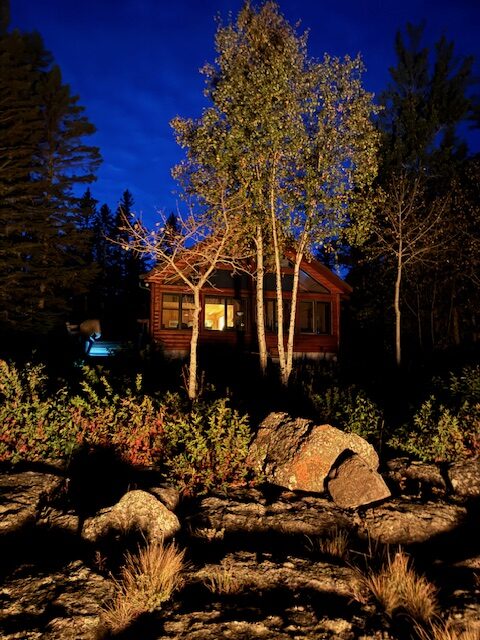
7:43 pm on 10/1/24… the cabin backlit by the early evening light.
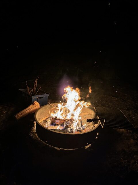
8:30 pm on 10/1/24 …the end of our day, fire light on the rocks and a stunning display of stars overhead in the night sky.
A writing assignment was to answer this question… Has a stranger ever helped you at a difficult time? The answer is yes, and here’s the story.
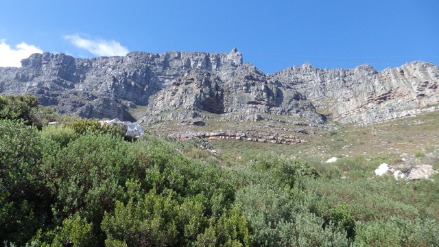
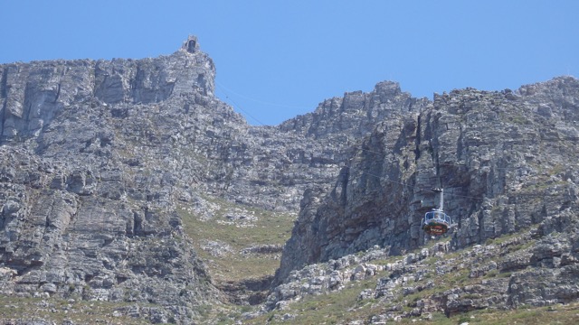
Table Mountain in Cape Town, South Africa. photo vb
In 2015 we visited our son and his wife and our first grand-baby, Zoey, in Mozambique, Africa. We planned a side trip to Cape Town, South Africa as a chance to see another part of the continent. One of our most exciting, but challenging adventures there was to climb Table Mountain.
Photo by Robert Huczek on Unsplash (free internet photos)
Table Mountain is a beautiful sight overlooking Cape Town, and from a distance it looks like a table, thus the name.
A view of Cape Town off one side of Table Mountain. photo vb
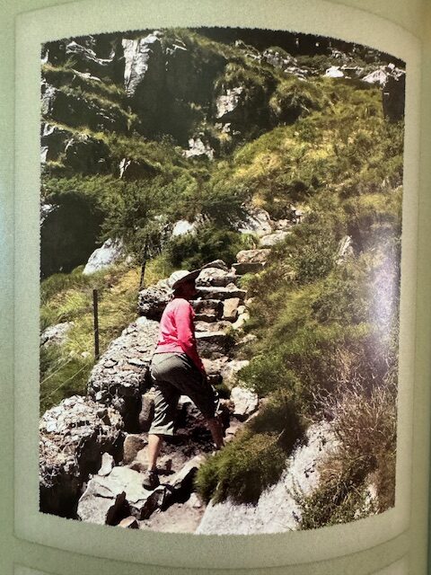
Gary and I are used to hiking and have done a lot over the years. We’ve hiked some difficult terrains. Table Mountain ended up being one of the harder hikes I’ve done, but I didn’t know that when we started out. We donned our hiking boots and hats, and filled our water bottles and started up the steep path. There were several other hikers on this trail. It was hot, it was rocky, and it was pretty much straight up.
On our way up the rocky trail to the top of Table Mountain. photo gb
We were struggling. About two-thirds the way up there was an outcropping that provided a shady area, so we stopped to rest. A fit, young man came from behind us and noticed I was overheated. He asked if we had water. Yes, we did, thank you. Then he said to me, hold out your hat. I did as he said, and he poured HIS water into my hat and told me to tip it over my head. I did, and it felt so incredibly good to drench my hot self with the cool water.
After that, the young man continued on his merry way, and I was so grateful for his random act of kindness, and soon we continued our trek upward.
Note the cable car coming down from the station at the top of Table Mountain. photo vb
We rejoiced when we arrived at the top. We joined many folks enjoying the stunning vistas on this beautiful, sunny day (reaching the top by cable car or on foot). Then, as was our plan, we took the cable car down the mountain.
From the window of the rotating cable car, going down Table Mountain. photo vb
I was grateful for this young man’s random act of kindness that day on Table Mountain. What a delight to be treated so kindly… on a mountain trail… in a foreign country.
On my drive out to Nerstrand state park, I was thinking about our Minnesota State Parks. They are definitely a valuable resource and I’m thankful they have been established so that I/everyone can get outside in nature, and explore.
I was greeted by wild geranium.
I haven’t been to all 65 of the state parks, but we have visited many of them over the years. We did a lot of camping in earlier days.
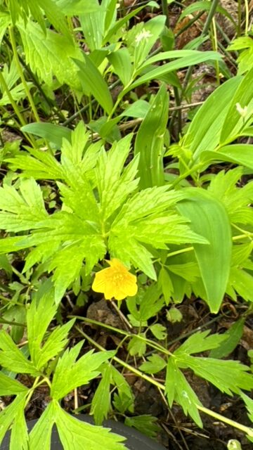
Buttercup
There are seven state parks along the north shore of Lake Superior that are scenic and connect to the “big lake” somehow. The others, scattered throughout the state, are inviting too. Nerstrand Big Woods State Park is about a 20-minute drive from our house. Maybe because I frequent it so often all year long, it has become one of my favorite state parks. A place to hike, to picnic, to camp…a place of beauty and rejuvenation… and so close to home.
Into the woods…
As I starting walking down a familiar trail and saw the lime, spring-green leaves overhead (unique to this season), breathed in the fresh air, and heard birds singing, I sighed; this is exactly what I needed. I was happy to be here.
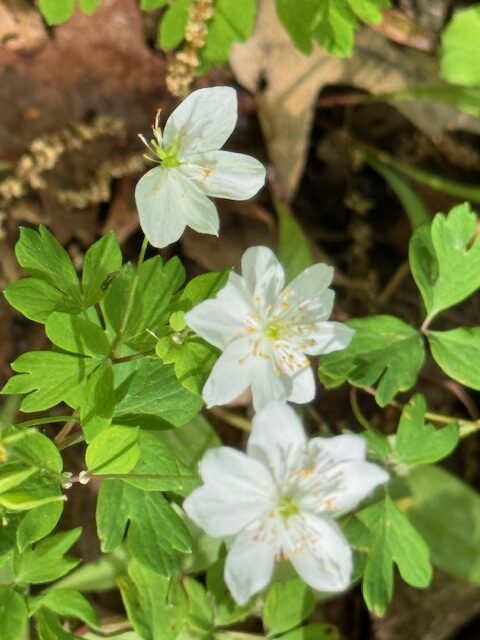
Rue anemone
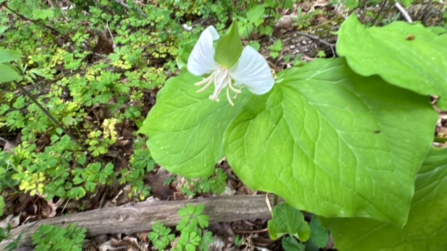
I was a little late to see some of the more familiar spring ephermals in bloom…the dwarf trout lily (found only in a few places in the world) being one of them…but there were other spring flowers blooming and it was fun to walk along and identify them.
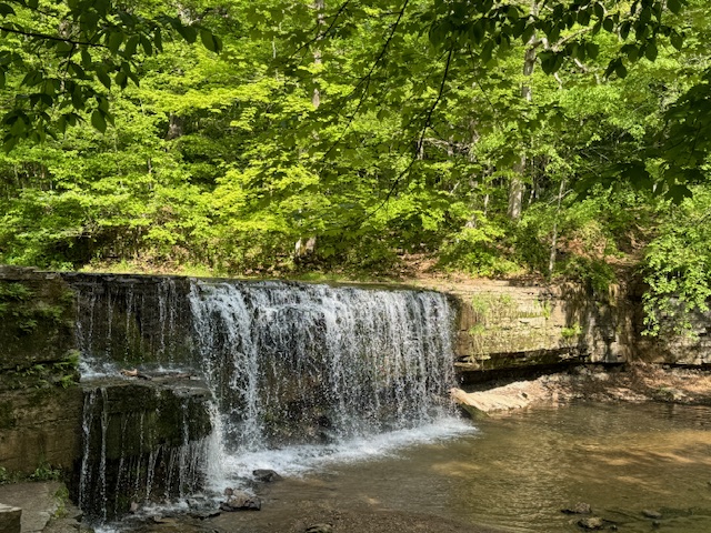
Hidden Falls
Many of the parks, especially along the north shore, have water falls, as does Nerstrand. Hidden Falls is smaller, but still lovely. The recent rains made for a full spilling over. I sat and watched the mesmerizing water flow.
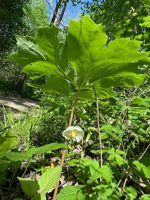
This beautiful bloom hangs under the large leaf of the mayapple plant. You need to look for it.
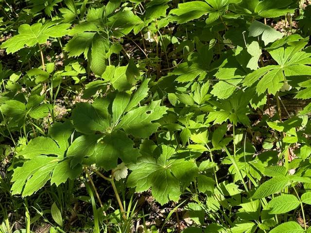
There were many mayapples with hidden blooms underneath their umbrella leaves.
I always feel safe walking the trails by myself in this park.
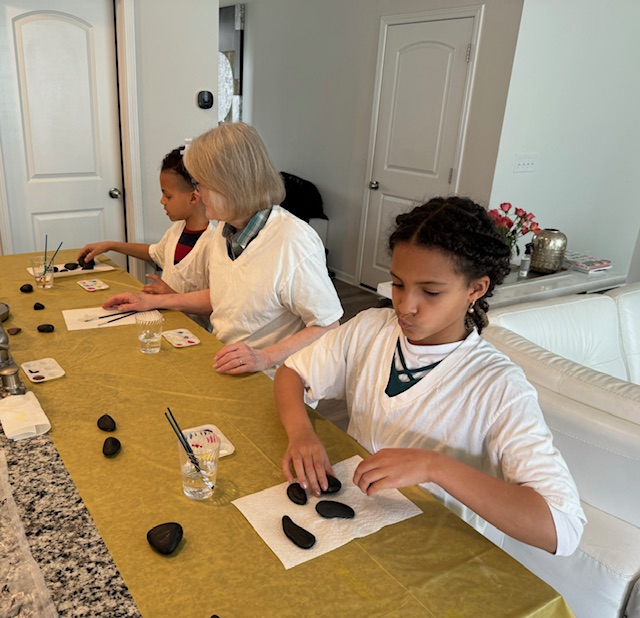
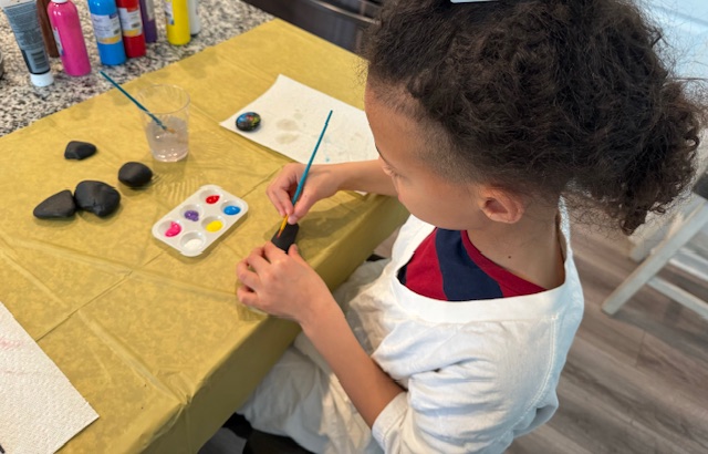
On our recent trip to visit our son and his family in North Carolina, I brought along my rock painting materials. I had collected several smooth stones for the grandkids to paint, and I prepared them ahead of time by painting the background black.
The set up…
We set up our work area by placing a cheap, plastic table cloth over the kitchen island. We put on old t-shirts to protect our clothing.
The creative juices…
We took out the paints and put a few drops of paint in each indention of the little palettes I brought along. We set out our paint brushes, and a glass of water in a plastic glass to clean our brushes in-between colors. Then we sat down to paint.
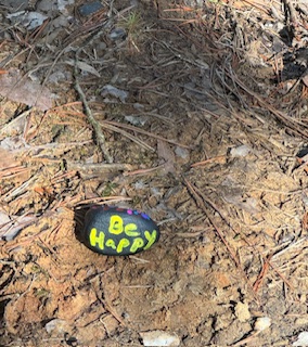
We each painted about 6-8 rocks with non-toxic acrylic paints. We painted some designs but mostly words (and some design with words). Our intent was to bring them on our next hike and place each stone strategically along a path for others to find the painted rocks.
Brush to rock…
The kids loved that idea, although they did want to keep a couple rocks for themselves. I sprayed lacquer, to set the paint color, on the two they wanted to keep.
Placing the rocks along the trail…
The next day we went to the near-by nature preserve, which we visit often. On our hike we stopped occassionally, to place a painted rock on the ground next to the trail, hoping someone would enjoy finding these special treasures.
I know I always enjoy finding positive messages in unexpected places. A good time was had by all, and hopefully for those who find the rocks.
The grandkids have gone home and the Christmas decorations and beautiful Christmas tree have been taken down, and it feels too quiet in the house.
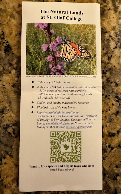
A brochure with a map was at one entrance to the trail.
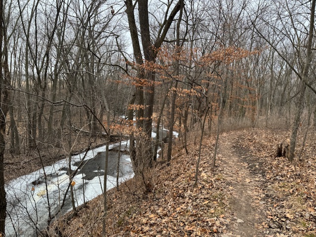
The trail along Heath Creek.
Nature always offers healing energy and is good for the soul, so we have done some hiking to help move on and to take advantage of this mild December/January weather (and no ice).
Heath Creek.
Over the past few days, we have hiked at Big Woods Nerstrand State Park, walked the Dundas Trail and on paved paths in the north section of town, and hiked in the lower Carleton arb with the Faribo Flyers bike club. There is a lot of evidence of beaver activity along the river in the lower arb…well over 50 trees taken down.
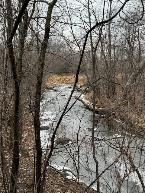
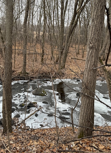
Swirls of white snow and ice make pretty pattern on Heath Creek.
We also hiked on a trail in the St. Olaf College Natural lands. There is a well-defined, wooded trail that meanders along Heath Creek, and it is a hidden gem. The winter landscape is pretty for this time of year; there is light snow and ice forming patterns around the rocks in the creek, the forest floor is full of brown oak leaves. The water is flowing strong and you can hear the sound of the babbling brook as you walk along side it.
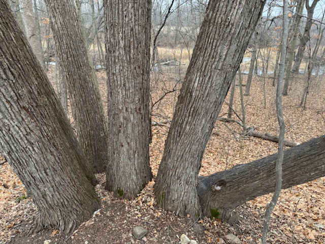
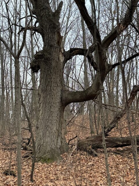
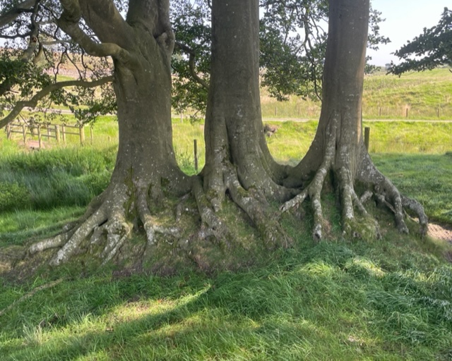
Six tree trunks growing out of one.
There are many mature oak trees on the trail, and some with unusual characteristics that is noticeable without its foliage. One has a branch growing straight out from the trunk, another tree has six sturdy trunks coming from one lone trunk. A very huge oak tree has fallen over the river…the enormous root system upended on one side of the creek, the trunk laying across the creek, and the upper part of the tree with its large branches on the other side of the creek…it almost could be a bridge across. (I couldn’t capture it on photo).
This oak tree has a branch growing out at a perpendicular level.
We had hiked this trail before, maybe a year ago, but now that we’ve rediscovered it, I think we will be hiking it more often.
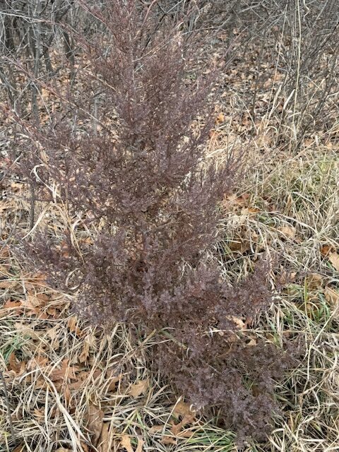
I didn’t recognize this reddish tree. My app told me it was a red cedar.
It’s nice to have so many green spaces (natural spaces – as they are not so green in the winter) to access within such a short distance of Northfield. Each hike this week was enjoyable in its own way, and rejuvenating.
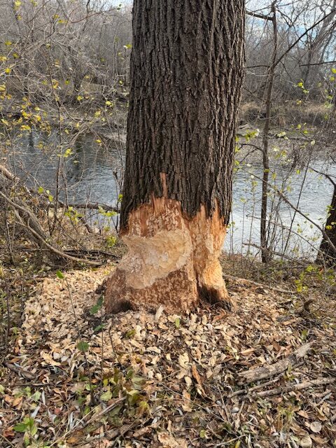
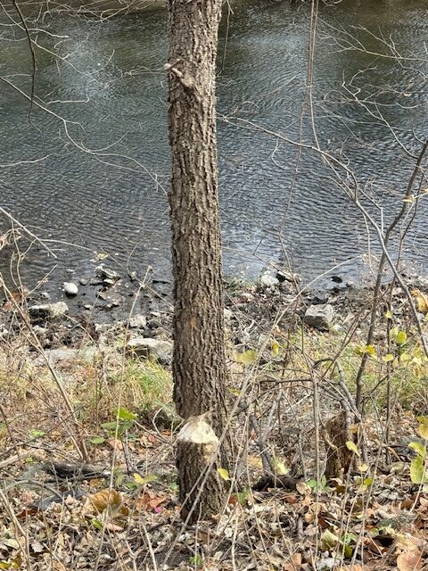
We were enjoying a hike in our neighboring town of Faribault, on one of the last warm days of fall. The section of trail we were walking along had trees on one side and the Straight River on the other. I was looking toward the river when I noticed what looked like beaver shavings on the base of a very large tree.
Evidence of beavers gnawing on this huge tree.
We stepped off the trail to check it out, and sure enough there was evidence of a beaver, or beavers, gnawing its way around this massive tree. But we wondered, can a beaver really gnaw its way through this huge tree?
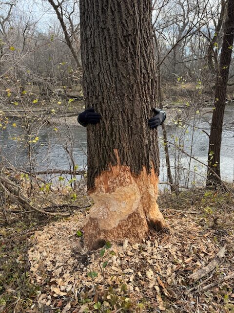
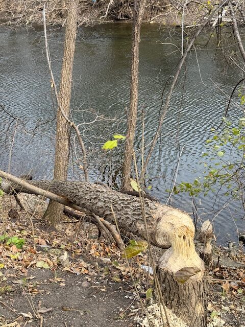
This is a photo of Gary hugging the tree. He cannot reach his arms around this large tree the beavers are working on.
Gary couldn’t even put his arms around the tree it was so wide. Was this the work of one busy beaver, or several beavers?
I do believe if one were so inspired, you could dress for the weather, park yourself at the near-by picnic table, sit quietly, and wait for the beaver to come back to work on this massive endeavor, because it will take some time for any beaver, or a colony of beavers, to fell this tree.
This size tree seems to be where we usually see beaver markings…
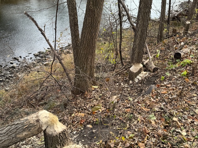
Lots of beaver activity along the Straight River.
Farther along the trail we saw more sightings of beaver activity…only the trees were more reasonably sized. Even so, some nice trees were being leveled. We couldn’t see the dam the beavers must be working on.
This tree is felled but has not been taken away yet…
The animal kingdom is amazing…beavers born with big teeth and flat tails to construct their homes…skunks spraying nasty, unpleasant scent to protect themselves…hummingbirds, the smallest bird, having energy to migrate twice a year spanning up to thousands of miles to stay warm…
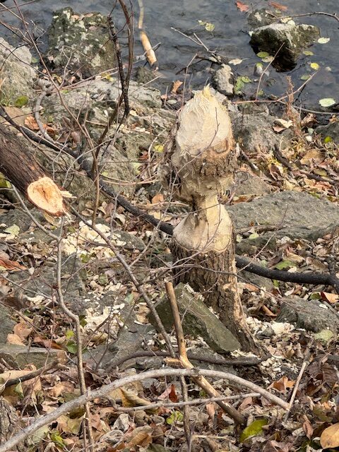
An artistic design left behind by beavers…a shapely stump.
“All creatures great and small, the Lord God made them all.”*
All unique. All wonderful. All Amazing.
*From Cecil Frances Alexander’s poem: All Things Bright and Beautiful (1818)
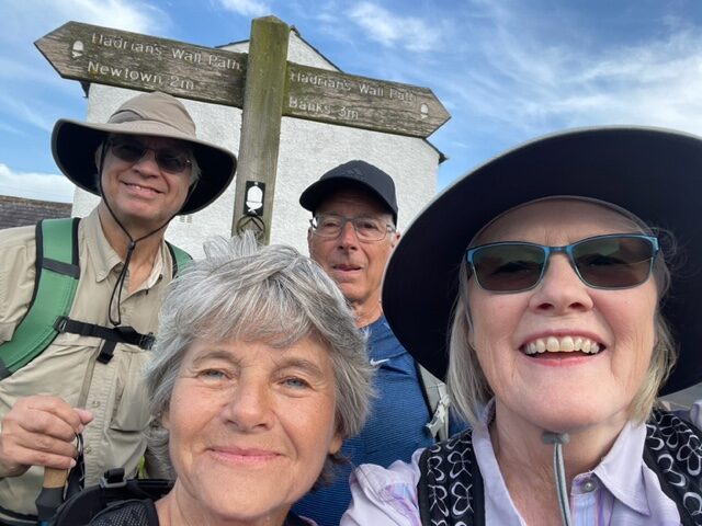
I didn’t know much about Hadrian’s Wall when we chose to hike it. I loved the idea of hiking from inn to inn, and I’ve enjoyed seeing pictures of England’s countryside, so why not there? We hiked a thirty-four mile section of the Hadrian‘s Wall Path, which is an eighty-four mile coast-to-coast trail in northern England.
It was interesting to learn about this path that follows the course of an ancient Roman fortification wall. The construction of the Roman wall began in AD122 under the orders of Roman Emperor Hadrian. It was considered both a defensive barrier and a marker of the northern reaches of the Roman empire.
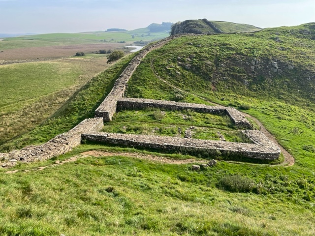
The original wall was 20 feet high and 10 feet wide. At each one-mile interval they had stone structures called milecastles which housed 32 soldiers.
Evenly spaced between the milecastles were two stone observation posts called turrets. Additionally, the Romans had built numerous forts in proximity to the wall.
Back in its day, there was a garrison of around 20,000 soldiers from across the empire at Hadrian’s Wall. After three centuries the Romans left, and many stones were pilfered to be used to build stone fences, and stone houses, by the local people.
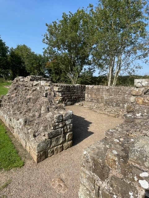
John Clayton, in the 19th century, spent 50 years excavating Chesters Roman Fort and many other Hadrian’s Wall sites and is credited for saving Hadrian’s Wall. It is now a UNESCO World Heritage Site. There is a museum along the way, next to Chesters Roman Fort, with amazing artifacts that John Clayton excavated and collected. It was fascinating.
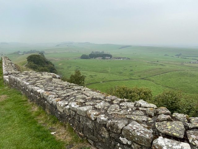
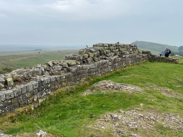
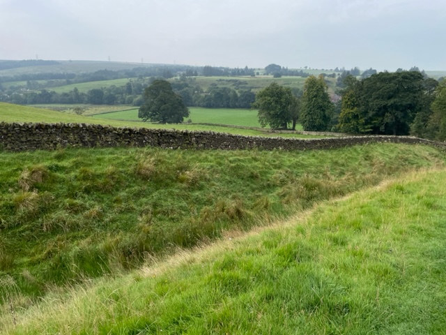
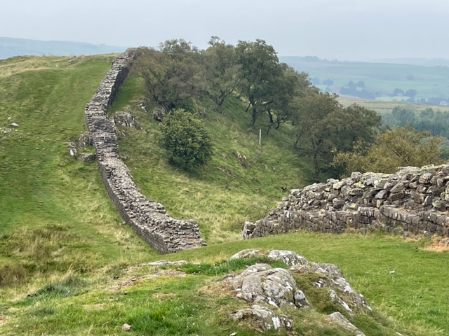
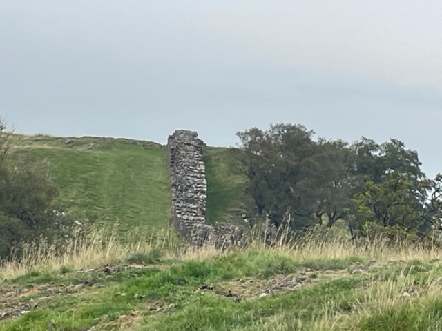
Today, the stone wall is intact in several places, up to 20 feet high, but then only a remnant stone, or nothing visible, in other places. Foundations and remnants of forts, milecastles and civil settlements were enroute with spectacular English country landscapes as the backdrop.
We hiked mostly in open countryside, although there were trees in the periphery… in the farm pastures and beyond.
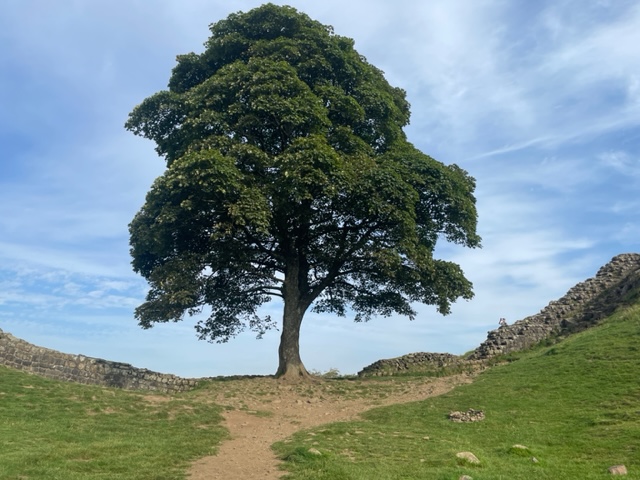
One lone sycamore tree at the bottom of a gap along the Wall is very picturesque, and been seen in several movies apparently – one being Robin Hood. If you hike along the Wall path, it takes you down the gap to the tree, and then you walk back up the other side. The tree is stately and magnificent (and 300 years old!) The area is known as “Sycamore Gap”.
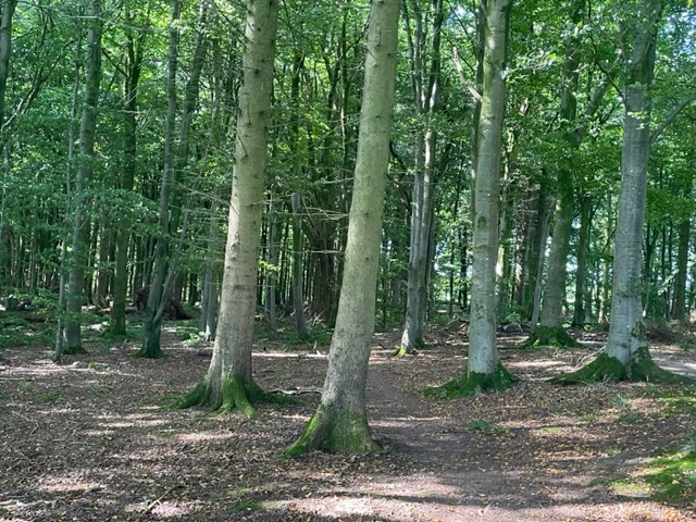
There was a small portion of the trail that goes through a wooded area…a fairy forest we called it.
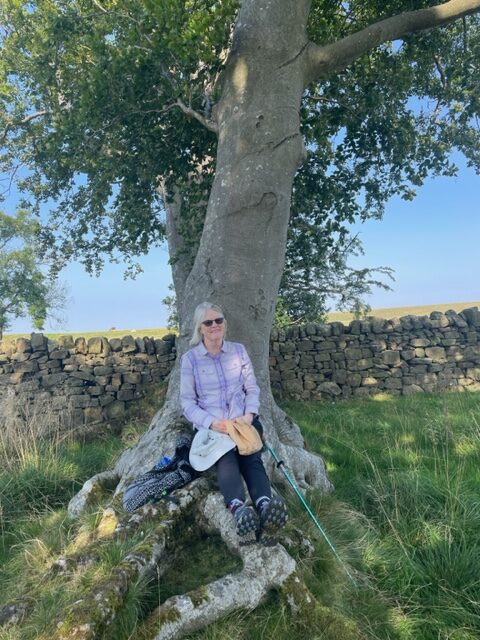
And there was a copse of trees with protruding roots that provided a perfect place for us to sit and eat lunch one day.
Beauty surrounded us on our hike, and we were grateful for the opportunity to walk this Walk through this amazing setting.
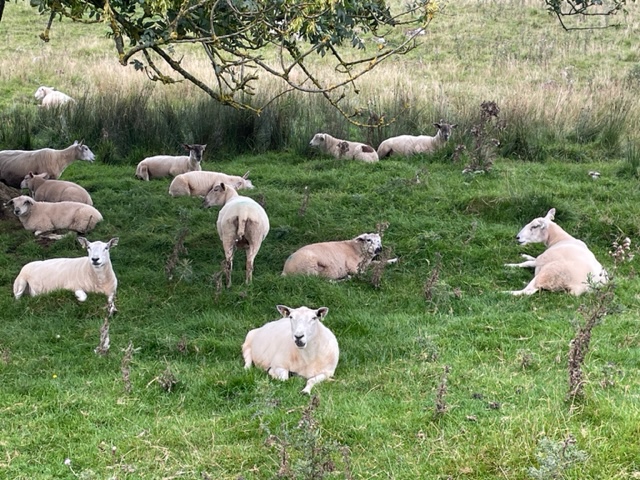
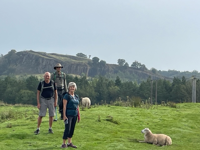
We saw thousands of sheep on our recent trip to Great Britain.
Sheep, sheep…I took lots of photos of sheep!
Thousands.
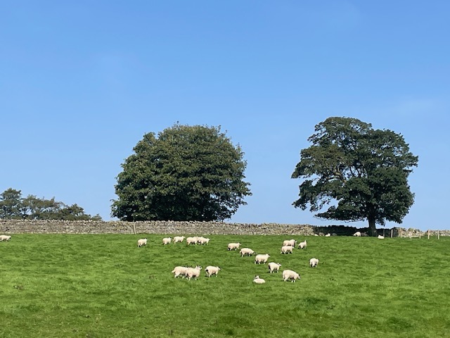
Pastoral setting…sheep, and trees, and green pasture, and blue sky, and Hadrian’s Wall…
I’m thankful they were sheep and not goats. I like sheep – goats, not so much.
Sheep are everywhere.
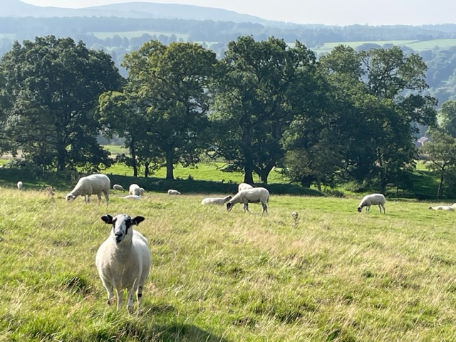
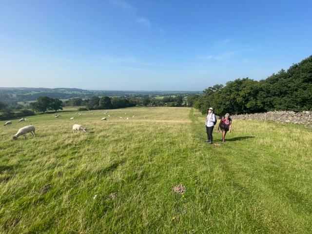
Not only were the sheep in fields along the highways and byways, but we walked right next to them in their pastures as we hiked along Hadrian’s Wall in northern England. The sheep didn’t seem to mind us hikers. They tolerated our presence and our antics towards them.
Docile sheep looking at my fellow travelers.
But the sheep also didn’t care about where they did their business as we had to carefully (and constantly) step around all the sheep droppings. They chewed their cuds as they watched us make our way through all their poo, maybe with smiles on their faces. I still think they’re cute.
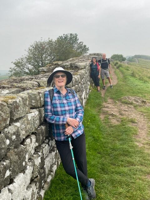
The four of us at the beginning of our hiking adventure.
Our first steps on the first morning – walking on the road to get to the trail.
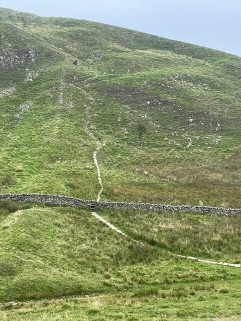
Sheep on one side, Wall on the other, expansive views of beautiful English landscapes surround us.
Only two times did we miscalculate our steps, and needed to stop and clean out poop from the cervices of our hiking boots.
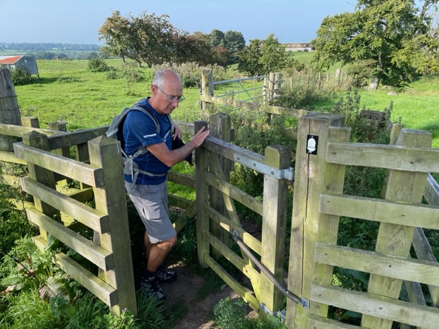
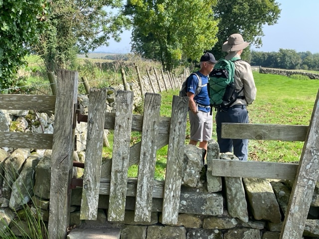
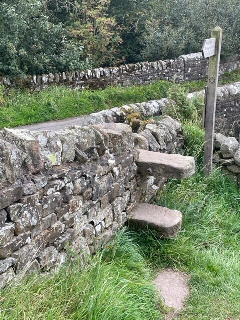
We went through many gates…
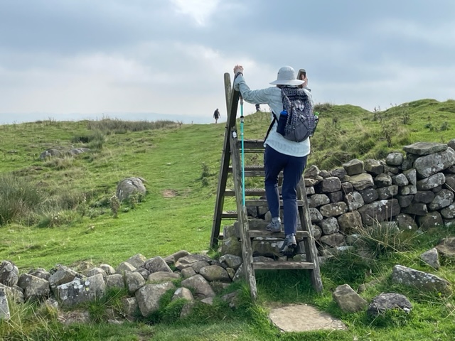
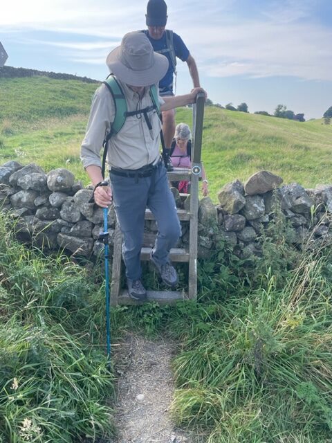
And climbed over many stiles.
Climbing over a stile.
Through the gate.
There were also stone steps in a few places.
We were prepared for what is typical Scottish weather, cool and rainy, on our four-day trek along Hadrian’s Wall. Instead, we had unusually warm, humid and sunny weather. Although we were hot and sweaty as we hiked, it was preferred to the cold and rain.
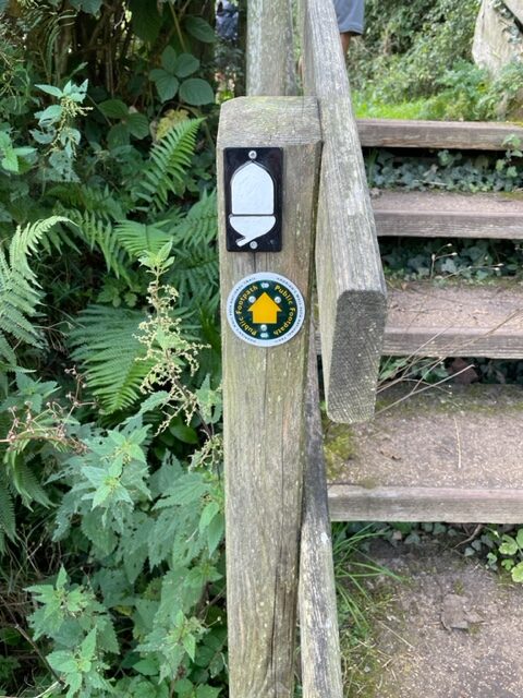
The white acorn was the trail marker for Hadrian’s Wall.
The terrain was more rugged than we anticipated, but it also made for interesting scenery and amazing vistas. We walked a total of 34 miles in four days. We were hiking from inn to inn.
Hadrian’s Wall…following it up and down…
A section of Hadrian’s Wall.
At the end of the day, we hiked off road to an inn where there were rooms reserved for us, and our luggage was waiting for us.
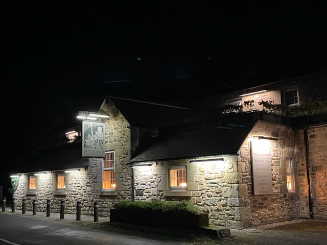
The Battlesteads B&B…located in an International DarkSky Place.
As we hiked, we only had to carry our backpacks with water, our lunch and a rain jacket (which we didn’t need).
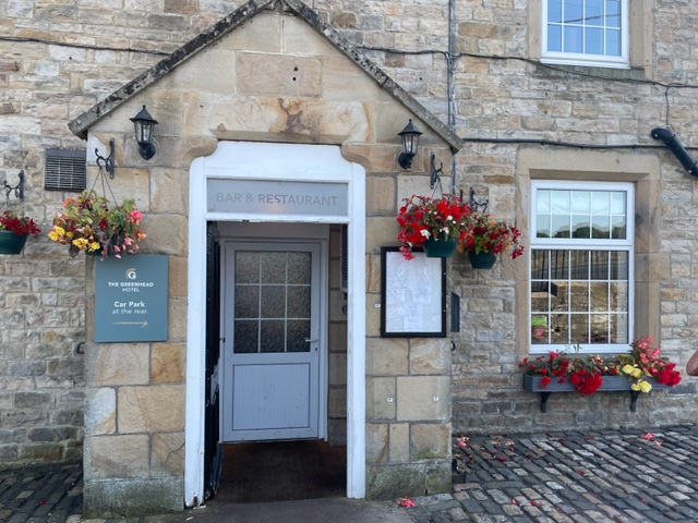
The Greenhead.
All the inns provided for our needs of a place to sleep, dinner options, breakfast the next morning, and packed lunches for the trail.
Twice Brewed Inn, in the town of Once Brewed! Love the names!
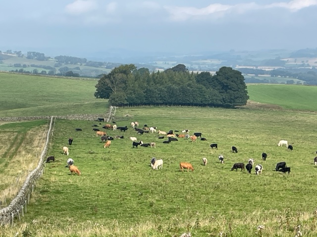
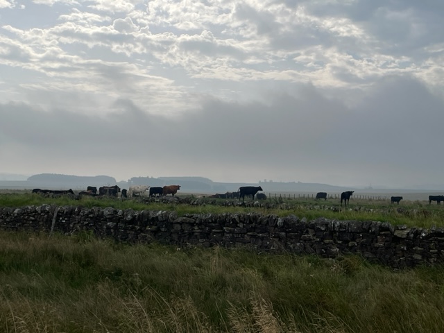
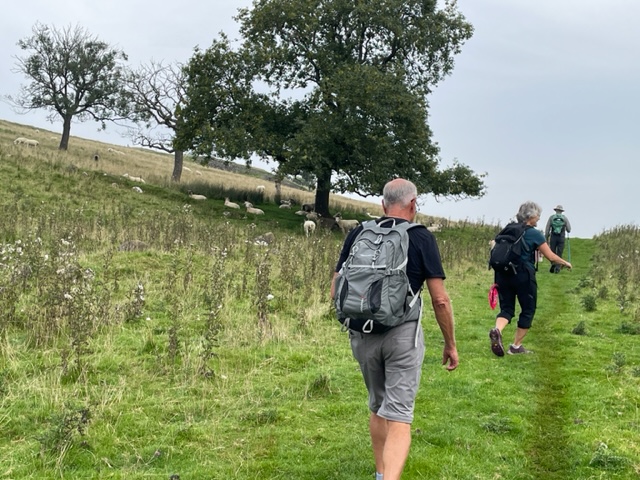
Pastoral scenes, beautiful and expansive vistas, Hadrian’s wall, sheep, various cattle, personal and lively conversations, and occasional fellow pilgrims on the trail provided our entertainment.
Walking along the trail…sometimes we could see Hadrian’s Wall, sometimes not. It’s old. It was built in 122 AD, by the Romans in Britain, as a former defensive fortification, during the reign of the Roman Emperor Hadrian.
And we had a marvelous time!
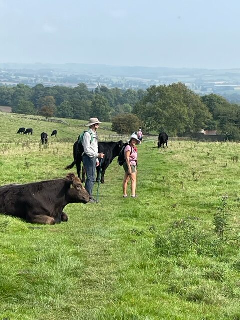
We sometimes had to watch out for cow pies too!
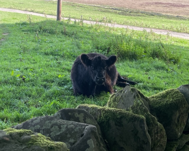
This cow watched as we walked off trail, by a farm, on our way to an inn for the night.
On these glorious mornings, Gary and I are walking on trails we’ve recently re-discovered.
A sliver of a sea of yellow.
We park outside the Oaklawn Cemetery and pass through the gate to Carleton College’s Cowling Arboretum…the upper arb. (The lower arb has nice trails too…it goes along the Cannon River and through the woods. The entry point is at a different section of campus.)
From the entrance we use for the upper arb, you can choose to go to the right or left. The right leads down to the prairie, the left takes you through an heavily wooded area of oak trees, and all the trails connect.
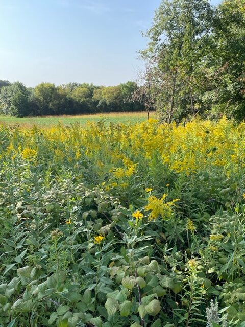
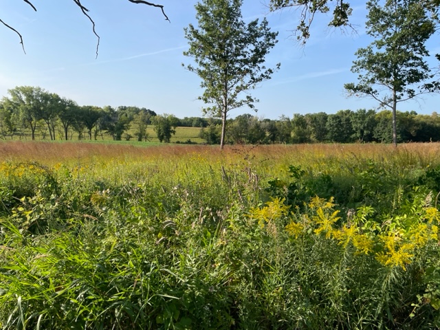
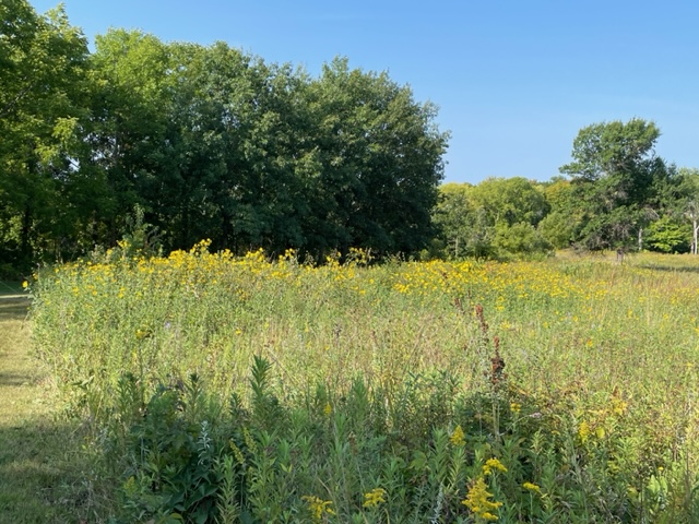
The beautiful landscape with amber tips of prairie grass and golden rod…
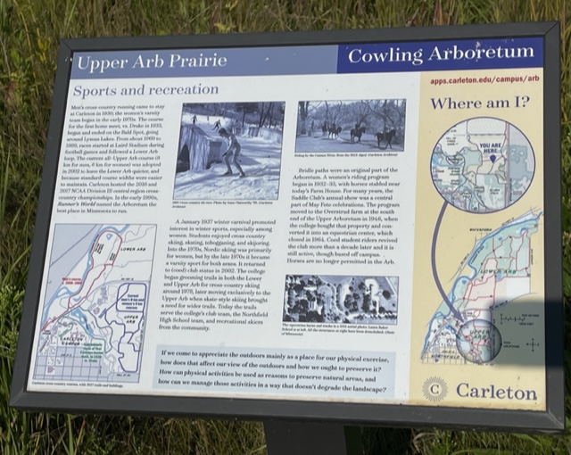
A posted sign offers information on how the different sports have worked-out on the upper arb over the years.
An interesting and informative sign about the upper arb and sports activities.
Carleton’s cross-country teams (men’s began in 1938 – women’s in 1970), practice on the trails and hold track meets. In the early 1990’s, Runner’s Magazine voted the upper arb the best place in Minnesota to run.
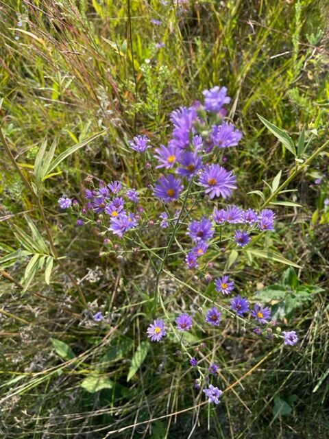
Purple prairie wildflowers…
Carleton College started grooming the trails for cross-country skiing in 1978, and continues to open the trails to all skiers. We have skied and snow-shoed in the upper-arb during winter.
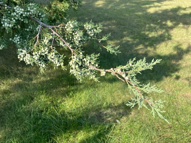
Juniper trees were abundantly full of berries.
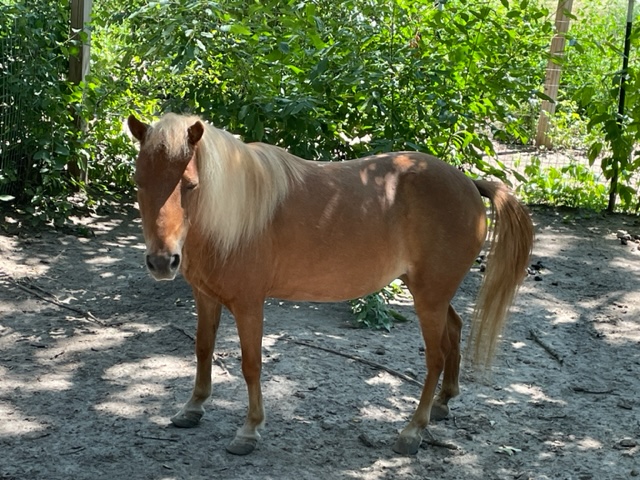
I enjoyed learning that in the 1930’s there was a Saddle Club, and horse and riders were permitted to jaunt on the trails. An equestrian center was also built on the upper arb, but was shut down in 1964. It would be fun to ride horseback on the trails, although it is no longer permitted.
This photo added for fun…this is Abigail, one of the animals I help care for once in a while (not at the arb).
We have done a bit of walking on the trails in the upper arb in previous years, but not during this time of year when the prairie is in bloom. It is so pretty!
Intersecting trails.
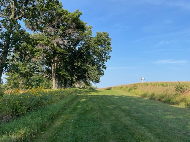
It feels like we’ve discovered a whole new trail. We pass very few folks out on our morning hike. We have the trails mostly to ourselves.
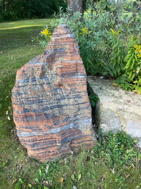
The striated lines on this boulder stood out.
A beautifully, landscaped boulder rest area.
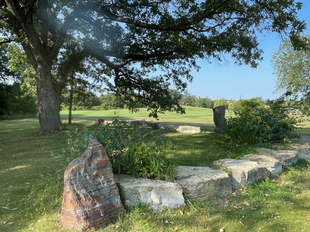
The sun shines on our path. The sky is blue. It is so peaceful.
A beautifully mowed path, with Carleton College’s water tower in the background.
We’re grateful Carleton Colleges maintains the trails, and opens them up to the public.
We just returned from an amazing time on the north shore of Lake Superior. As I’ve written before, it is one of my all-time favorite places to be. When we arrive at the cabin we rent, I sigh a happy sigh when I walk through the door and see the lake through the floor to ceiling windows. It is a marvelous and breathtaking sight that I never grow tired of. I literally feel a calm come over me. I miss it when I’m not there.
During our time at the cabin, we did what we normally do…we enjoy God’s bountiful creation. We bike and hike, drink our morning coffee on the deck, watch the sunrise, have a bon fire on the rocks, relax, read good books, eat delicious food overlooking the lake, and just sit and look at the lake.
I had good intentions of cleaning up my computer files, or deleting photos off my phone, do a little writing, but none of that happened. The lake is alluring and mesmerizing, and we can just sit and do nothing but enjoy the vista for hours…and so we do, and we do not worry about getting anything accomplished. I believe we are being rejuvenated from the inside out.
We traditionally go up to the north shore in September but this year we had reservations in July. The weather was cooler than normal for July, the sunrise is earlier in July…5:20ish…and different kinds of flowers are blooming in July…like beautiful lupines, perky daisies and bright yellow bird’s-foot trefoil.
A photo exposition follows:
A view outside the cabin. I was pleased to see lupines on the property. We started seeing lupine along Scenic Drive as we were driving up. Lupines are not in bloom in September, when we are usually at the cabin.
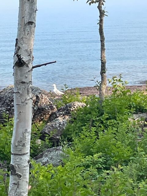
Seagulls are an added treat to watch.
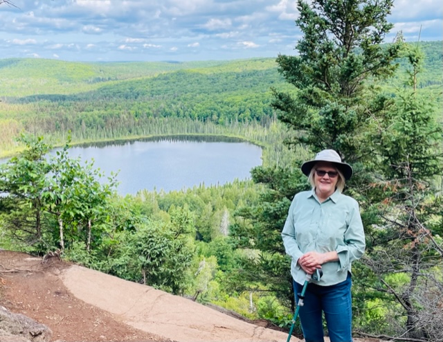
One of our hikes…overlooking Oberg Lake in summer, 2023.
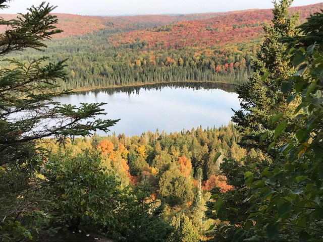
This is same overlook of Oberg Lake in autumn, 2019.
Streets lined with gold…Highway 61, back roads and bike trails were lined with bird’s-foot trefoill. It was impressive.
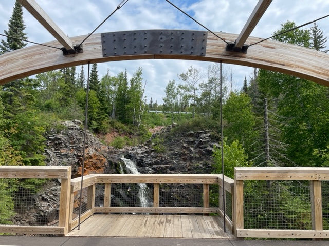
This is a bridge on the new section of the Gitchi-Gami bike trail, which we rode on from Cutface Wayside Park into Grand Marais.
Temperance River…a hike we always enjoy, along the gorges of this wild river.
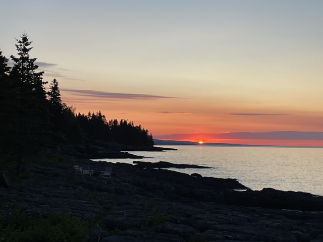
Sunrise on July 16, 2023 at 5:24 am.
We enjoy a bon fire on the rocks outside the cabin.
Clear water reveals the rocks underneath the waters of Lake Superior.
Our hike to Caribou Falls…down 156 steps to see this beautiful waterfalls, then back up 156 steps! It’s worth it. It’s gorgeous.
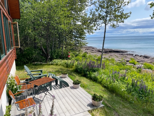
We enjoy the deck off the cabin.
The lupines outside our cabin…
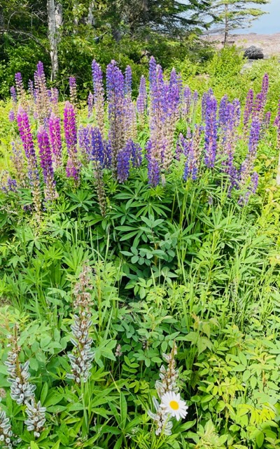
Our son Tim took a photo of lupines and a single daisy years ago…it was fun to recapture a similar posturing.
Lake Superior…some days it’s calm, other days it’s not…somedays it’s gray, other times it’s blue, sometimes it’s somber…sometimes it’s glistening… with everything in-between. And, sometimes it all happens in a day. (I told Gary these are the kind of glistening diamonds I like.)
I’m so grateful for our time on the shore of Lake Superior.